
Prior to this more serious time spent in Australia, I had already been to 60-odd countries. And I tell you, I did not supposed it would get me like that. Sydney, Bondi, perhaps the Opera House is what most people would imagine. They loop round, shoot the pictures, fly home. I get it. However, that form of Australia is just the tip of the iceberg.
What I found across three months, five states and more hours behind the wheel than I care to count was a country that rewards the people willing to go further, stay longer and resist the itinerary.
Where I’d Start and Why Most People Get It Wrong
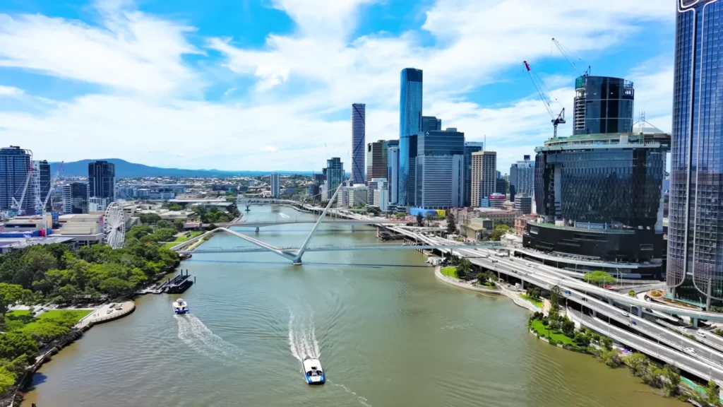
Brisbane is not given the credit it deserves. I received the same expression every time I mentioned that I was beginning there rather than in Sydney. But the Southeast Queensland has that which Sydney cannot really afford to offer any more, a feeling of space. The city is the home of an old slow river and all through the middle of it ferries glide back and over and there is this relaxed atmosphere that makes one feel like taking off his shoes.
I also started at Brisbane and drove north to the Glass House Mountains, volcano plugs that burst out of the pine forest floor with the explosions like something falling to Earth.
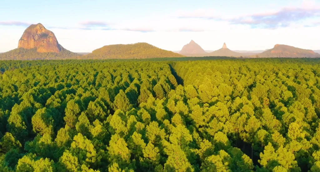
Mt Tibrogargan is 364 metres in height and it is very peculiar. In 1770, James Cook gave the peaks their names because of the glass furnaces he had observed in Staffordshire. I remembered that piece of information – this primeval volcanic scenery bearing the name of an English manufacturing town. Australia does that a lot. It’s superimposed histories surprise you.
A lot of people skip the Blue Mountains because they think of it as a day trip from Sydney. But I spent three nights near Katoomba and I’d argue the light on the Three Sisters at 6am before the tour buses roll in is one of the better things I’ve seen in this country.
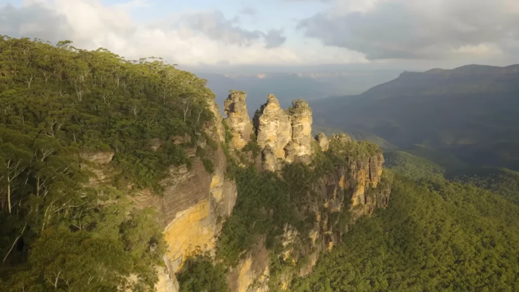
The sandstone formation is around 500 million years old and the Gundungurra and Darug peoples have stories about those three peaks that predate every map ever drawn of the place. Parks NSW has a solid breakdown of the cultural significance here.
Quick Planning Notes — East Coast Entry
| Starting Point | Best Season | Suggested Days | Don’t Skip |
| Brisbane | Sept – Nov | 3–4 days | Glass House Mountains drive |
| Blue Mountains | Apr – Sept | 2–3 nights | Jamison Valley walk, Echo Point at dawn |
| Cairns | June – Oct | 3–5 days | Reef day trip + Daintree |
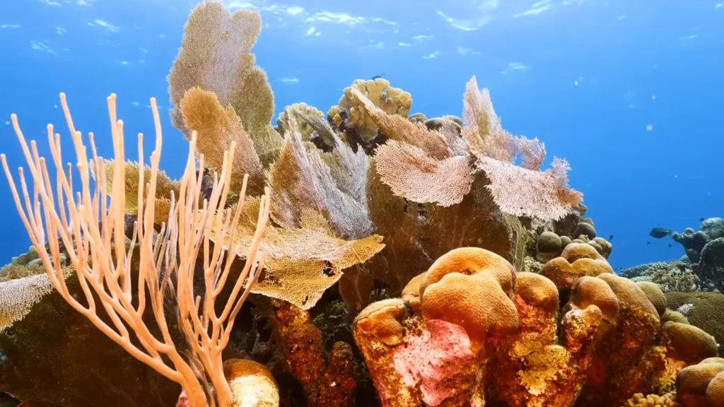
Up North — Where the Reef is Still Alive (Just)
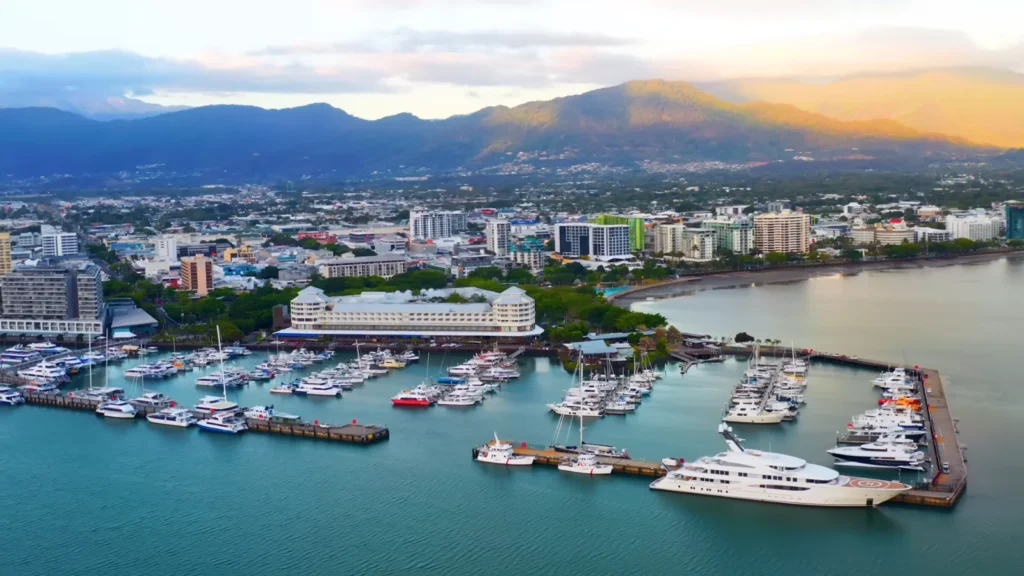
The type of place Cairns is is one that is better than it is said to be. The marina is swamped – the dive boats, the super-yachts, the reef-transfer cat-marines all bumping at the same jetties – and beyond the entire scene, the Atherton Tablelands stick up like a thorny hedge and catch the last of the afternoon sunlight. I did not love the town but it is a fantastic base of the reef.
The great barrier reef is 2,300 kilometres in length and it has more than 2,900 separate reefs. Any numbers are insignificant until you get in the water and can see a sea fan that has been growing 700 years long and a freediver floating silently at the top of it.
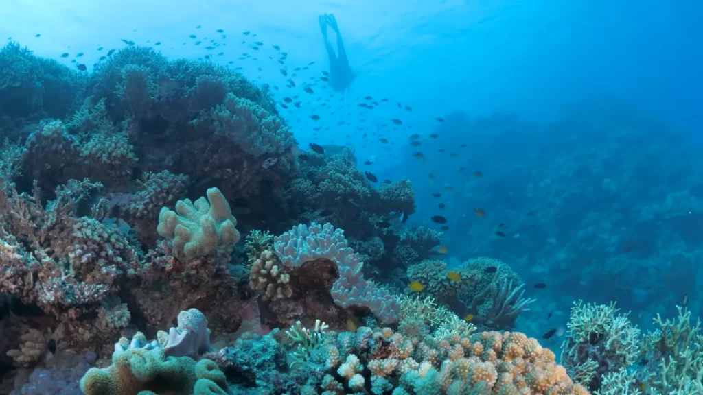
According to the Great Barrier Reef Marine Park Authority, the cover of the coral in the reef was bigger than half during the 2016-2022 period as a result of mass bleaching. That was important to me underwater, there is a certain sense of awe and grief that you get in diving on something that extraordinary and is at the same time obviously straining.
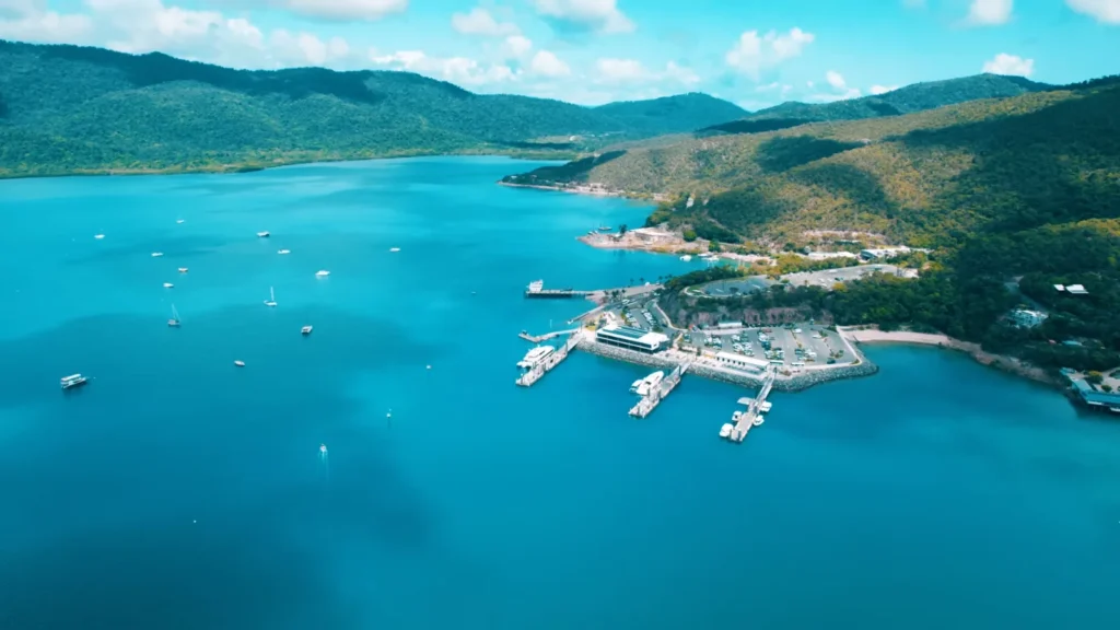
To the north of Cairns, the Whitsundays are of a quite different kind. The starting point is Shute Harbour a deep blue bay bordered by Conway Range rainforest with boats anchored everywhere.
One of such places is the Whitehaven beach on Whitsunday Island that has appeared photoshopped until the moment when you are standing on it. It’s sand contains 98 percent silica – it practically does not absorb heat, that is why it is cool to the feet even in the hot sun.
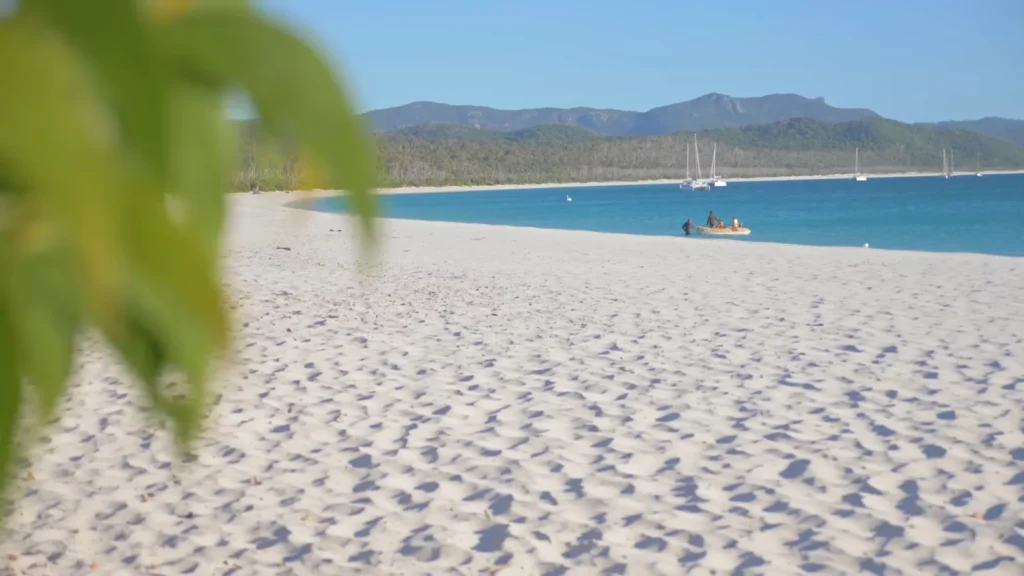
The sand changes, with the tide, along the Hill Inlet, as you can see in the lookout above – whirling white and turquoise forms, which vary with the hour.
What to Know Before Booking a Reef Trip
- Best visibility: June to October (dry season, calmer seas).
- Avoid: November to April — stinger season, some operators pause trips.
- Operators worth researching: Reef Biosearch, Passions of Paradise for snorkellers.
- Camera tip: Dome port housing on any underwater camera — the mix-shots of below and above waterline are what actually show the scale.
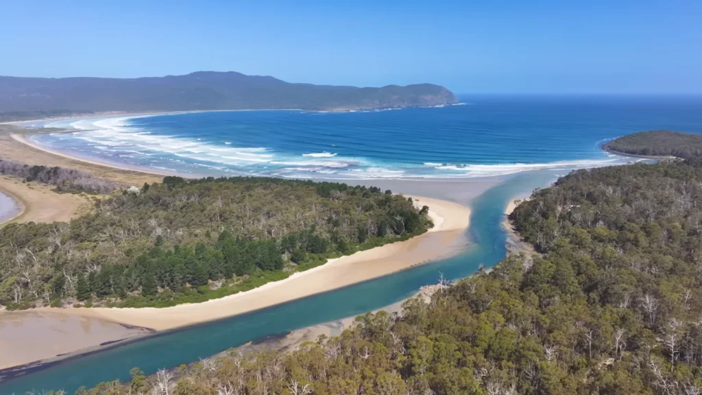
Tasmania — The Part of Australia Nobody Warned Me About
I flew to Hobart with wilderness in mind. I was not looking forward to feeling truly remote in 90 minutes of landing. Tasmania runs on an alternate frequency. The air is colder, the roads are skinnier, the trees are more old and the silences are more protracted.
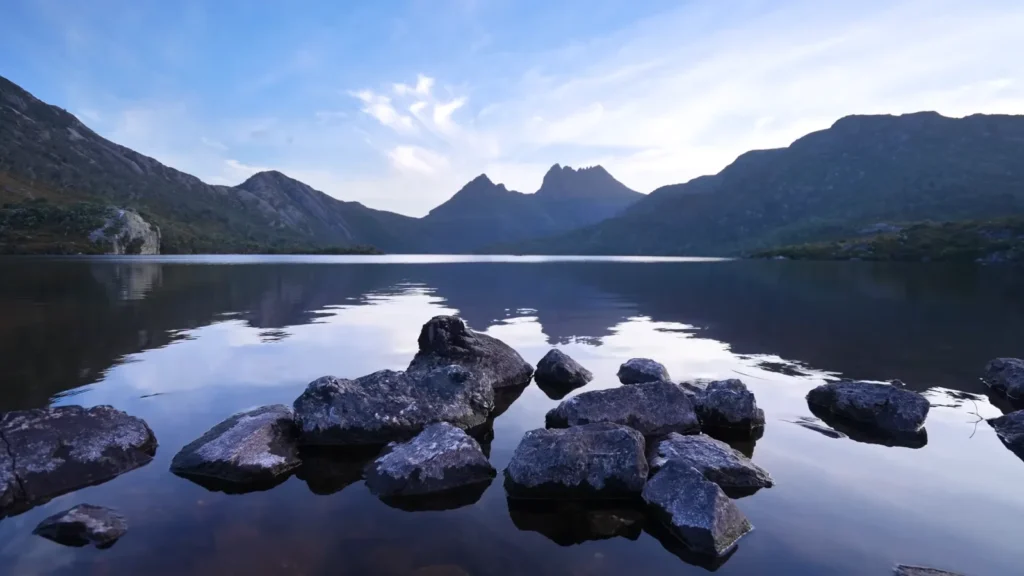
Cradle Mountain Dove Lake at dawn foreground stones, mountain in still water, no other human seen in the frame is the type of frame that makes you realize why photographers have been revisiting this island.
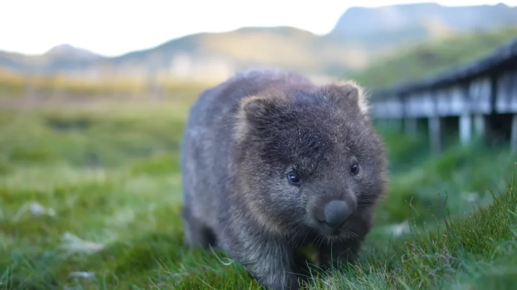
And then there was the wombat at Ronny Creek. It just wandered up to within half a metre of me while I was crouched with my camera on the boardwalk. Common wombats weigh up to 35 kilograms and can live 15 years in the wild that particular one looked young, maybe 18 months, still with that fuzzy juvenile coat. It ignored me completely and kept grazing. One of those moments that’s better than any planned wildlife encounter.
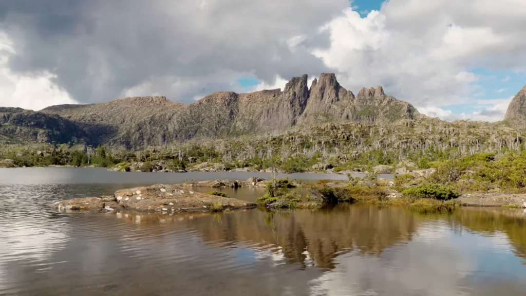
The walls of Jerusalem area found around Lake St Clair is more difficult to access but worth the effort. Tannin-brown water and storm light, dead pencil pines, grey, skeletal, about the shore. The two areas are managed by Tasmania Parks & Wildlife as a single World Heritage listing – 1.38 million hectares of preserved wilderness which forms the largest temperate rainforest in the Southern Hemisphere.
Cape Hauy -The Rock Climb That I Was Not Ready to Do
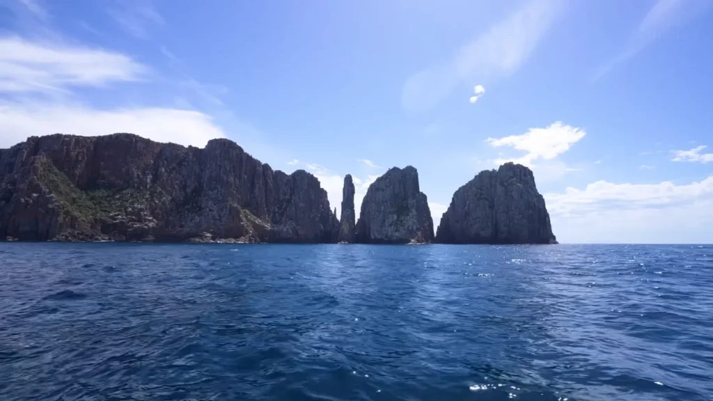
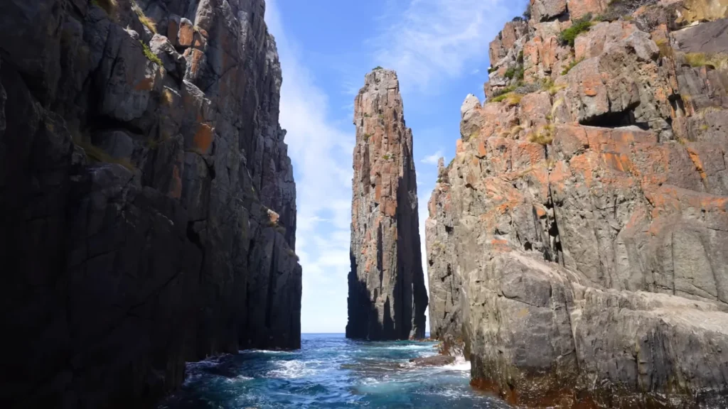
The Tasman Peninsula walk out to cape Hauy is approximately four hours walk both ways. At the end of it, there is a 300-metre dolerite sea stack named the Totem Pole 65 metres in height, less than 2 metres in width at the base, stuck between the cliff wall and the open sea. Between the headland and the stack is a narrow sea passageway and in the afternoon the light passing through the aperture in the stack changes all to amber and blue at the same time.
Tasmanian essentials:
- Get a taxi – the public transport does not go to the wilderness.
- The Overland Track (65km, 6 days) is a multi-day walk of serious nature – reserve months in advance.
- Unpredictable weather; carries thermal warning clothes in summer.
- Wildlife is everywhere at dusk drive slowly after 4pm.
The Red Centre — Where Australia Gets Existential
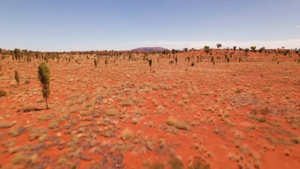
No one is ready to the magnitude of the Outback. I’d seen photos. I would read the figures, the Northern Territory all by itself occupies 1.35 million square kilometres and the number of population is about 250,000. But it is the drone shot that speaks the truth red spinifex desert, stretching to all horizons and in the middle distance, almost no bump, Uluru waiting there.
I had driven in through Alice Springs, some 450 kilometres south along the Stuart highway and westward along the Lassiter. Five hours of near-nothing. Some time after Erldunda, a road train passed me and I did not see a single car again in 40 minutes. Such loneliness disturbs you or puts something straight. For me it was the latter.

Uluru stands 348 metres above the surrounding plain. The visible rock is actually the tip of a much larger sandstone formation that extends kilometres underground geologists estimate the full structure is around 6 kilometres deep. It’s around 500–600 million years old, formed from sediment deposited in an ancient inland sea, then tilted almost vertical by tectonic forces over hundreds of millions of years.
The Anangu people have lived in this landscape for at least 30,000 years. The rock isn’t just a landmark to them it’s a living site threaded through with Tjukurpa, the law and stories that govern Anangu culture. Climbing was officially closed in October 2019, a decision that had been overdue for decades. Uluru-Kata Tjuta National Park is jointly managed by Anangu traditional owners and Parks Australia worth reading their site before you go, not after.
The sunset shot is the one everyone takes. I took it too. But what I wasn’t expecting was the hour after sunset when the rock goes from orange to violet to a deep, almost maroon darkness as the sky fades behind it. That transition lasts maybe 20 minutes and most people have already walked back to the car park.
Red Centre Fast Facts
| Feature | Detail |
| Height above plain | 348 metres |
| Estimated underground depth | ~6 kilometres |
| Age | 500–600 million years |
| Cultural custodians | Anangu (Pitjantjatjara/Yankunytjatjara) |
| Climbing closure | October 2019 |
| Nearest town | Yulara (Ayers Rock Resort), 18km away |
- Best time to visit: May to September daytime temperatures drop to 20–25°C; avoid December–February when midday heat exceeds 45°C.
- Sunrise vs sunset: Sunrise is quieter maybe a third of the crowd.
- Guided walks: The Mala Walk with an Anangu guide covers rock art and Tjukurpa stories worth every minute.
Western Australia — The Coast That Changes Everything
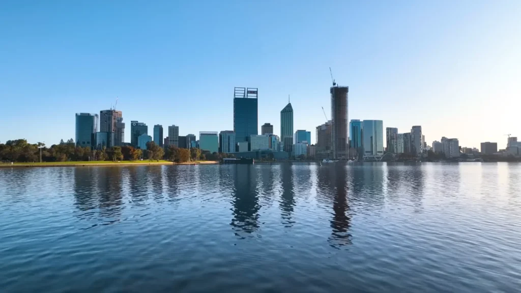
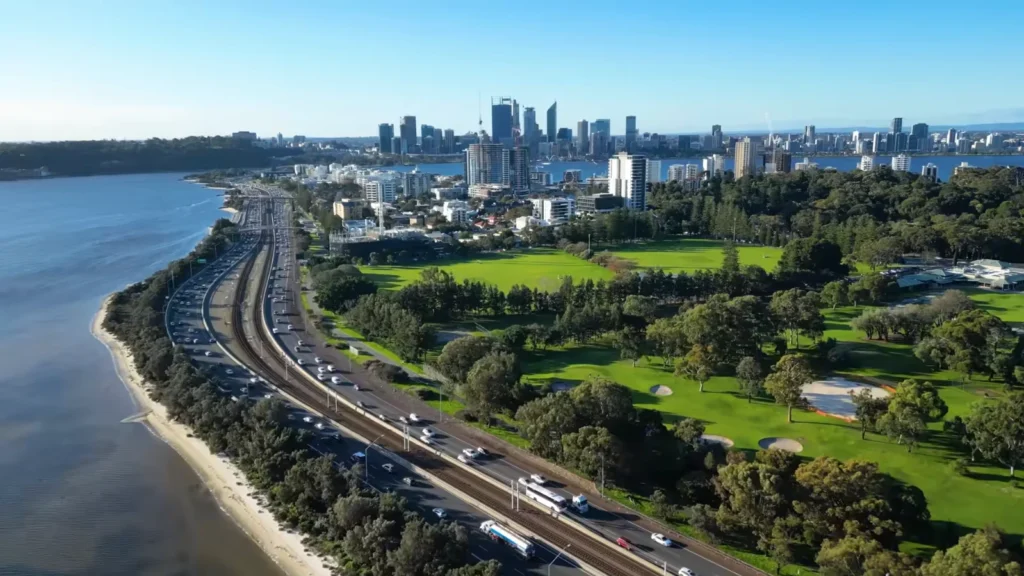
Perth is isolated than any other world capital city. The closest city that can be compared to it is the city of Adelaide which is 2,700 kilometres distant. The isolation is what makes the city unique, the way you can feel it. It has a self-sufficiency and a kind of carefree confidence that does not require any outside confirmation. The Swan River shot speaks it better than any tourism copy glass water, clean skyline, construction cranes, making it look like a city that is not yet a city.
I spent three days there, Perth as a base and that was by no means sufficient. Kings Park alone 400 hectares of bushland which sits over the city, is enough to keep you busy the whole morning. It hosts more than 3,000 native plant species and is located upon Whadjuk Noongar country and the cultural affiliation to the land by the Noongar people can be traced back to tens of thousands of years.
But the real reason to be in Western Australia is the coastline south and east of Perth. Specifically — Esperance.
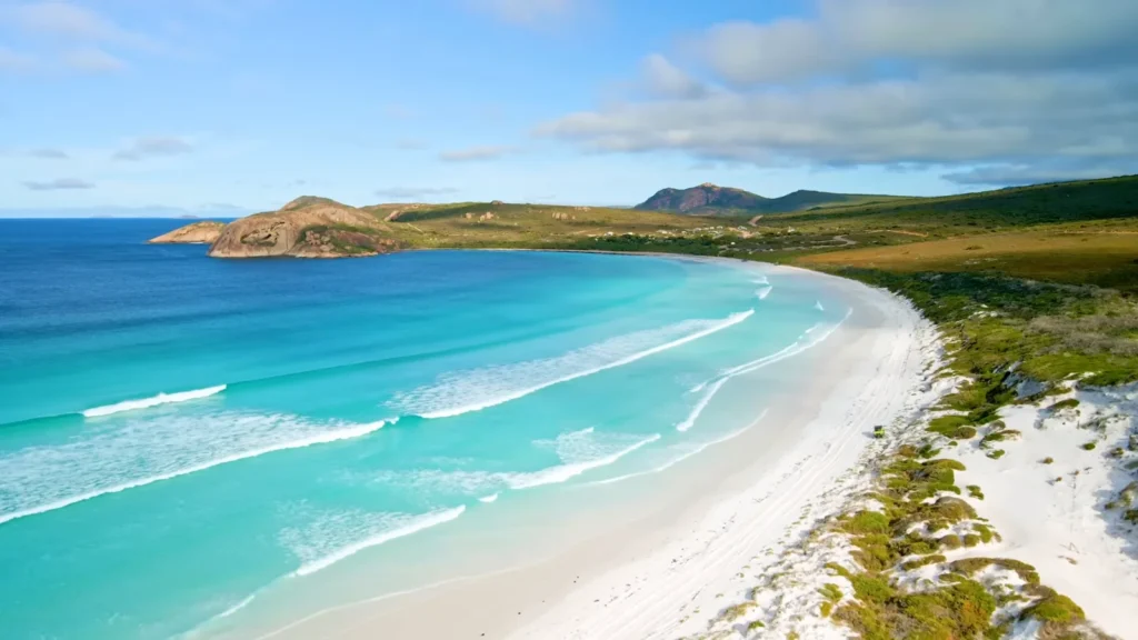
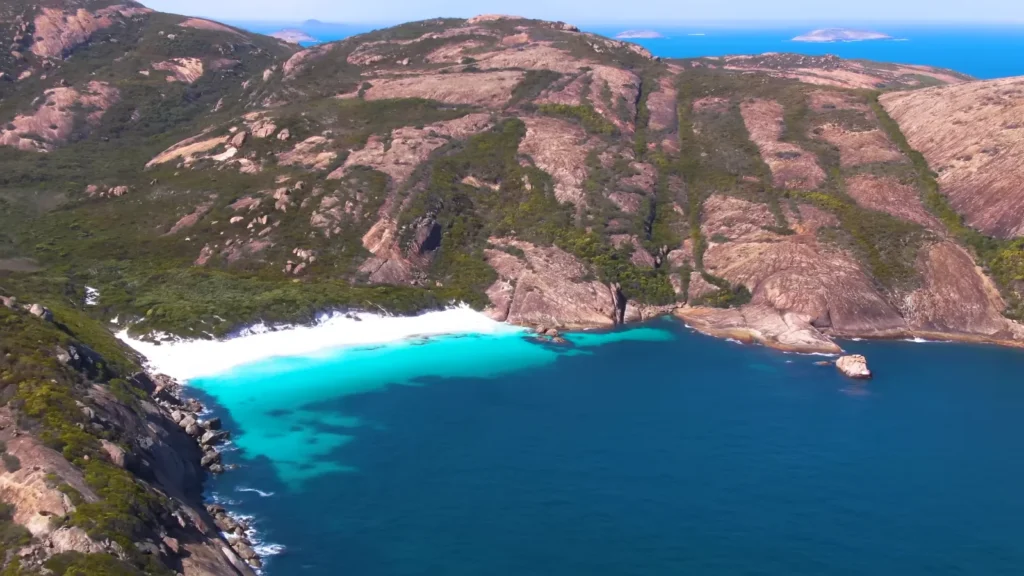
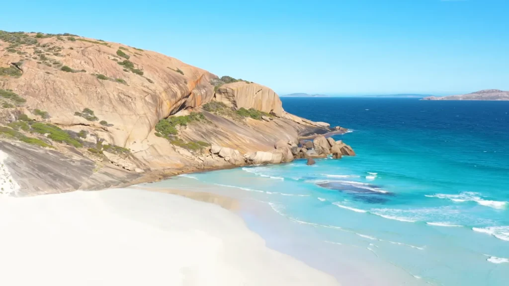
The beaches at Cape Le Grand national park which are located approximately 50 kilometres east of Esperance, are beaches that really mislead your mind. The sand in Lucky Bay is so white and the water so deeply turquoise that when you take a photograph of it, it is automatically labeled as edited – it is not. The sand of this place contains silica as much as that of Whitehaven and this, is not accidental; they are both formations of quartz which has been eroded in millions of years of shore exposure.
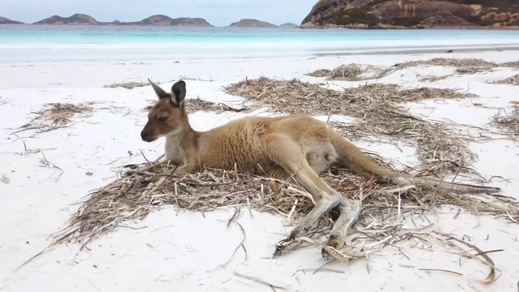
The grey kangaroos of the west which feed upon the beach at Lucky Bay, are not a sight of tourism, brought about by some one. They just live there. The one shot, the kangaroo being a young one, which was lying in the sand and the Southern ocean behind it, I waited about 25 minutes. Two times it yawned and fell asleep again.
The Cape Le Grand National Park is 31,801 hectares in size and some of the most intact kwongan heath vegetation in Australia – a flowering scrubland, which is spectacular to the eye between the months of August and October; it is also at this time of the year that the whale watching season is at it’s best along this coast.
Western Australia Coastal Comparison
| Location | Water Colour | Sand Type | Crowd Level | Best For |
| Lucky Bay, Cape Le Grand | Electric turquoise | White silica | Low–moderate | Kangaroos, swimming |
| Twilight Beach, Esperance | Deep teal | Fine white | Low | Sunset, surfing |
| Cottesloe, Perth | Blue-green | Golden | High | Accessibility, snorkelling |
| Cable Beach, Broome | Warm blue | Red-gold | Moderate | Camel rides, sunset |
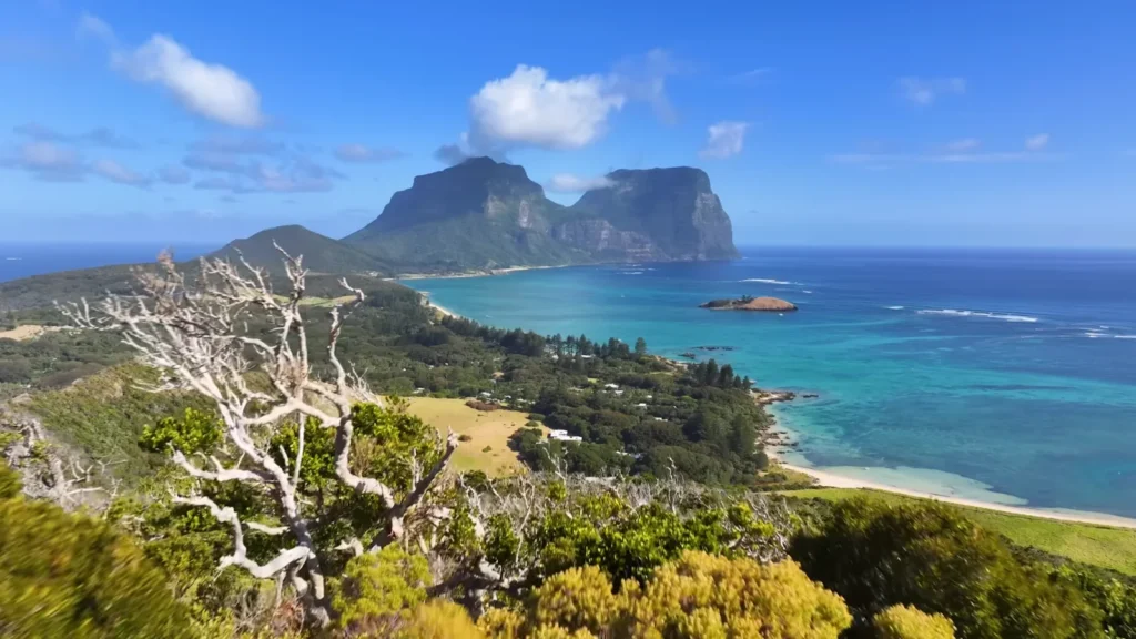
Lord Howe Island — The Place I Wasn’t Sure I Should Tell Anyone About
The Lord Howe Island is located 600km along the New South Wales coast, which is two hours away by light aircrafts of Sydney. The number of tourists that should be on the island is 400 only, no more and no less. The surrounding marine park is operated by NSW national parks and it has the southernmost coral reef in the world.
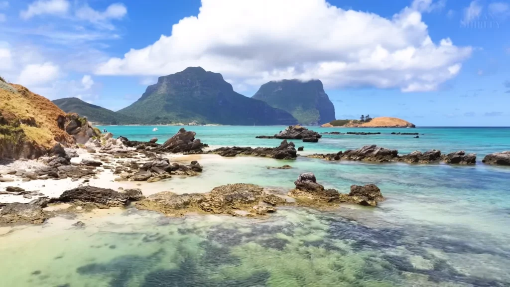
What impressed me first, I will tell thee; that is, the silence. Not the absence-of-city quiet. Something older than that. At the south end of the island- dominating all the views, is Mt Gower, 875 metres – almost vertical basalt. The lagoon thematic of the two peaks receives the light in different ways each hour. Looking down at the settlement between the jungle and the water, one would think that it is not real.
The island has no traffic lights. No chain stores. About 360 permanent residents. The reef in the lagoon is genuinely healthy because access is controlled and has been for decades. A snorkelling trip over the coral there, with visibility sometimes exceeding 30 metres, is a different experience to anything you’ll get on the more accessible parts of the Great Barrier Reef.
Lord Howe basics:
- Flights from Sydney (2hrs) or Brisbane (2.5hrs) via Qantas/Eastern Air Services.
- Book accommodation 6–12 months ahead the tourist cap means places fill fast.
- Bikes are the main transport; most accommodation includes them.
- Ball’s Pyramid a 562-metre volcanic spire 23km south of the island is visible on clear days and reachable by boat.
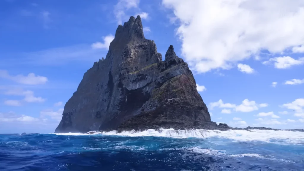
Ball’s Pyramid is the tallest volcanic stack in the world. It rises 562 metres directly from the ocean with no beach, no ledge, just sheer black basalt meeting deep water. In 2001, scientists discovered a colony of Lord Howe Island stick insects living on a tiny bush 100 metres up the rock face an insect believed to be extinct since 1920. That story alone is worth looking up. The full account in National Geographic reads like fiction.
Final Thoughts — What Three Months Actually Taught Me
Australia is not one country in any meaningful experiential sense. The distance between Uluru and Cape Hauy is greater than London to Tehran. The ecosystems don’t overlap. The light is different, the silence is different, the wildlife is different. A person who’s only seen Sydney has seen one small corner of something vast.
The mistake most visitors make is treating it like a checklist. Sydney, Great Barrier Reef, Uluru done. What gets missed is the texture: a wombat at Ronny Creek deciding you’re not interesting enough to acknowledge, kangaroos that commute to the beach every morning in Esperance, the 20 minutes after Uluru’s sunset that most people miss because they were already walking to the car park.
Three months wasn’t enough. It rarely is, with places that matter.