
By Phil Waukee
I was told by some one on the way out– Slovenia? Is not that a part of Slovakia? I get it. It is a quiet type of country. No huge advertising budget, no star endorsements. Only 20, 271 square kilometers of mountains, rivers, castles and coastline quietly lying in the heart of Europe, waiting that you should bump into it. I did, in the end of September and frankly? It was the bane of all other places I had gone that year.
What got me first wasn’t Bled everyone leads with Bled. It was the drive from the Austrian border into the Julian Alps. The road just… drops into this valley and suddenly there are limestone peaks on both sides and the light’s doing something absurd. I pulled over twice before even reaching my hotel. That should tell you everything.
Ljubljana: Small City, Massive Personality
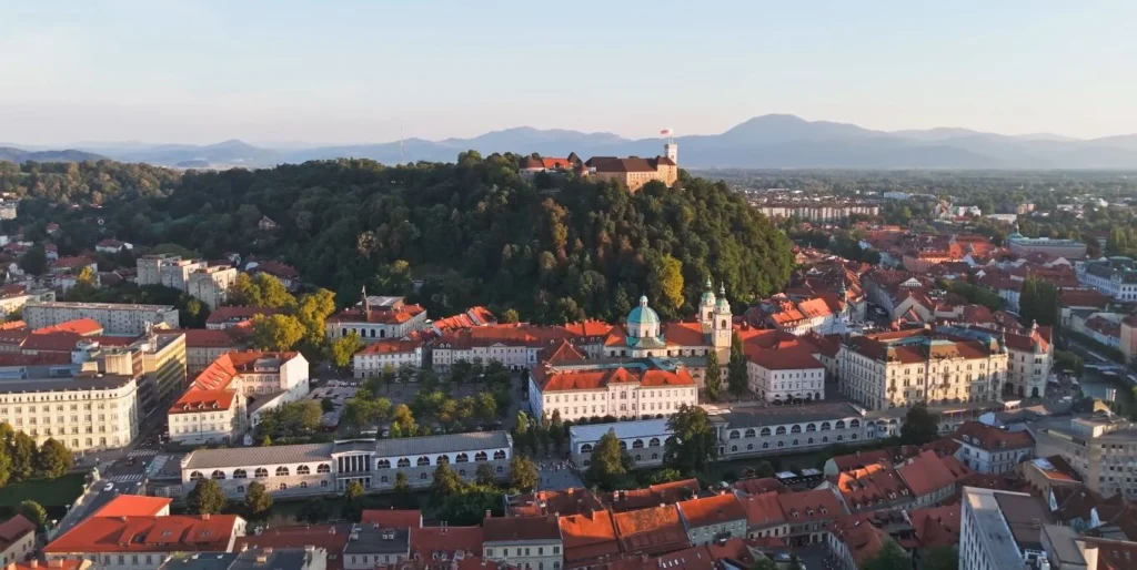
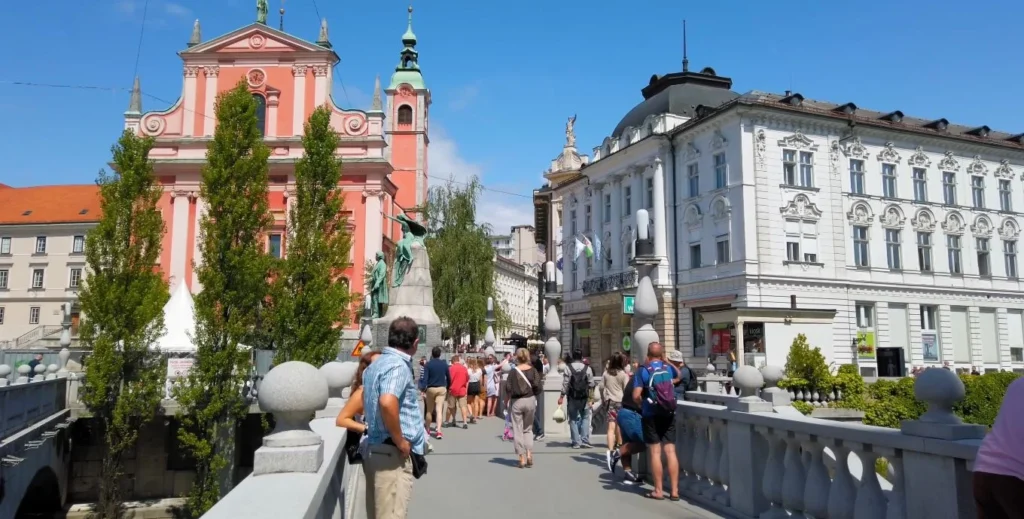
The majority of capital cities bombard you. Ljubljana does just the opposite- it sucks you in slowly. The entire old town is car-free, putting it already above half of the European capitals. I spent my first afternoon simply walking over the Triple Bridge – three parallel bridges next to each other, built between 1842 and 1931 – and watching the Ljubljanica River flowing beneath and why I had never heard of this place.
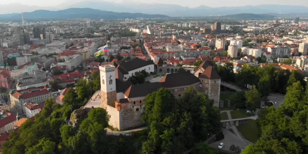
The Ljubljana Castle is a castle constructed on a hill with forests on top of the old town. You can walk up or there is a funicular– I walked, of course. The whole city is dispersed, top to bottom: the red roofs, the green dome of the cathedral, the flat of the Ljubljana Marshes in the background. The castle is estimated to be 900 years old, although the first written account of it was in 1144.
A few things worth knowing about Ljubljana:
- Population is just under 300,000 — intimate by capital city standards.
- European Green Capital 2016 — the city banned cars from the center and it genuinely transformed the place.
- The river market is open every morning with the exception of Sunday, the fish market part being situated between the colonnaded hall of Plecnik well worth an early visit.
- The night life in the city is in fact in the Metelkova which used to be the military barracks converted into an independent cultural district rather than the tourist bars along the river.
I ate somewhere in the castle in a restaurant (Gostilna na Gradu) – slow food, local products, traditional Slovenian food. Štruklji (rolled dumplides), roast pork, wine in the Vipava Valley. Not very costly, but not mad.
Lake Bled: Yes, It is That Good
Ok, how about Bled? I was ready to be disenchanted – too much Instagram, too many people. I was wrong.
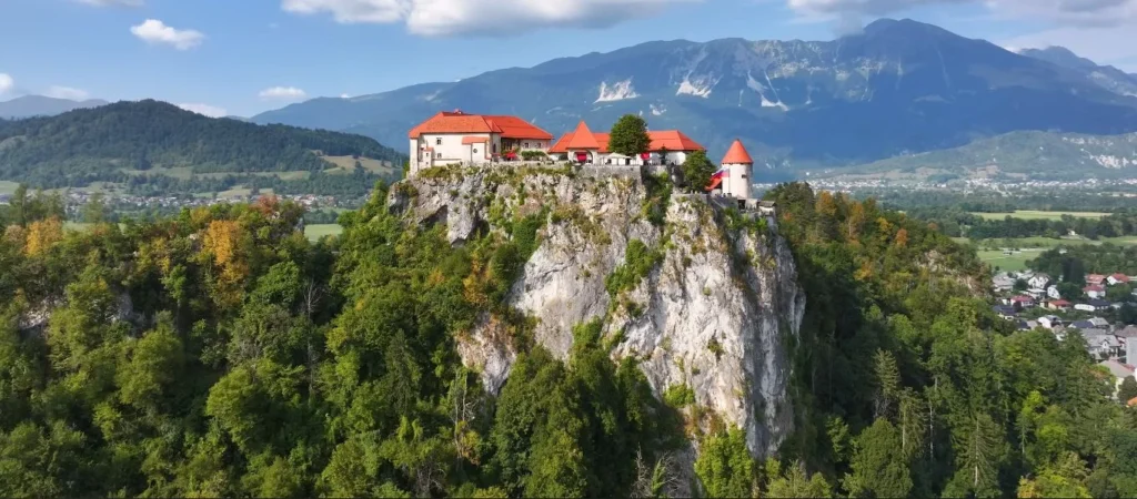
Lake Bled is in the foothills of the Julian Alps at 501 meters above sea level and is fed by thermal springs that cause the lake to be warmer than it would be otherwise. The only natural island in Slovenia is the central island, which has a church which dates to the 8th century, though the current building, in the Baroque style, is 17th-century. Locals say that you have to ring a church bell and make a wish and as a result that will happen. I gave it three rings, to be on the safe side.
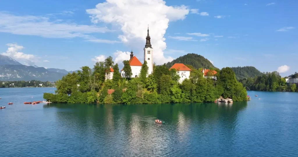
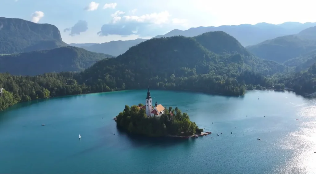
The castle is situated on the edge of the lake 130 meters on a steep cliff. It was a really medieval experience to walk up through the trees in the morning, before the tour groups had arrived. The prospect of the ramparts, with water below and Karavanke mountains behind and the island right in the middle is one of those views, which cause you to appreciate why people erect things in such absurd locations.
Bled Practical Info:
| Detail | Info |
| Best time to visit | May–June or September (avoid July/August crowds) |
| Island access | Traditional wooden pletna boat, ~15€ return |
| Castle entry | ~15€ adults |
| Swim spots | Grajsko kopališče beach, open May–September |
| Distance from Ljubljana | ~55km, about 1 hour by car |
One thing nobody tells you: get up at 6am and walk the lake. The whole 6km loop. Before the crowds. The water’s still, the light’s low and the castle catches the early sun in a way that the afternoon photos completely miss.
Lake Bohinj: Bled Without the Crowds
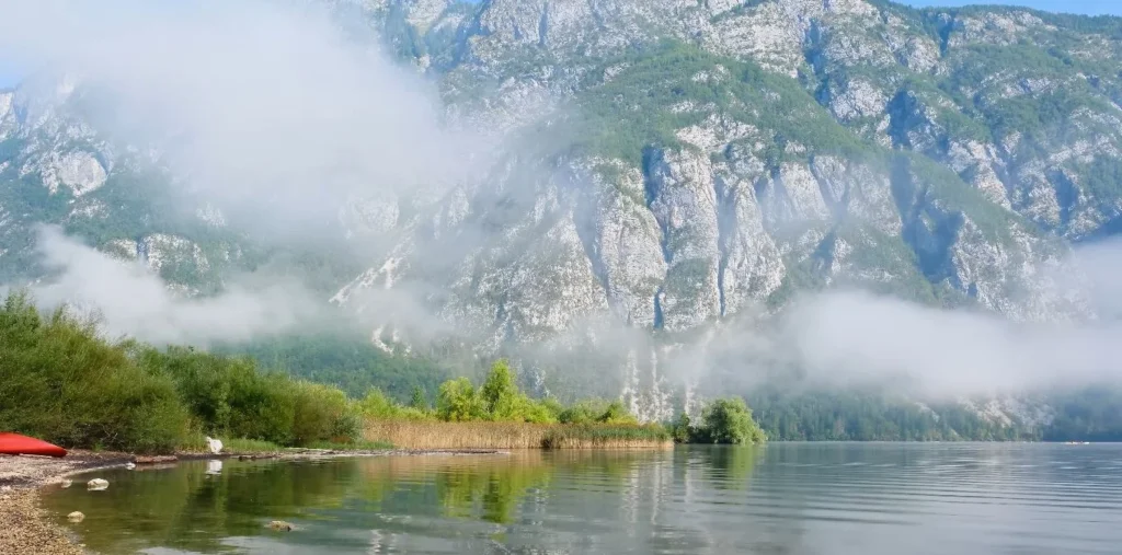
Bled is twenty-six kilometers away, across which lies Lake Bohinj, larger, more untamed and practically without the circus which covers it’s more popular neighbor. No island, no castle, 3.28 km2 of water carved by the glacier, in the midst of the highest mountains of Triglav National Park.
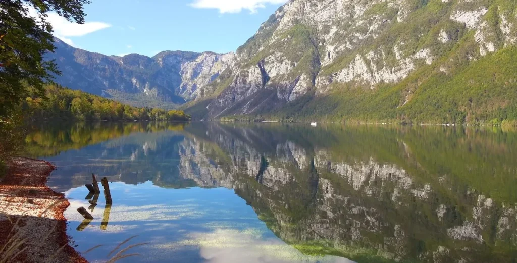
I reached a time when low cloud still hung on the cliffs on the east coast. The red kayak was paddling to shore on the pebbly beach, the reed-beds on the edge of the water,–it was as though someone had not yet finished a picture. The western end of the lake is reflected in a reflection shot with old wooden posts half-submerged in a perfectly still water, one of the best frames I ever chanced on without trying to get it.
Serious hikers also base their Triglav ascents in Bohinj. The mountain is the highest in Slovenia, 2,864 meters and the symbol on the national flag, somewhere beyond the cloud, to the north. A little more on that later.
What’s around Bohinj:
- Savica Waterfall — 78-meter drop, about 20 minutes walk from the car park.
- Vogel cable car — goes up to 1,535m for panoramic views over the lake.
- Ribčev Laz village — the main access point, has a 13th-century church of St. John the Baptist right at the water’s edge.
The Soča Valley: The Color Doesn’t Look Real
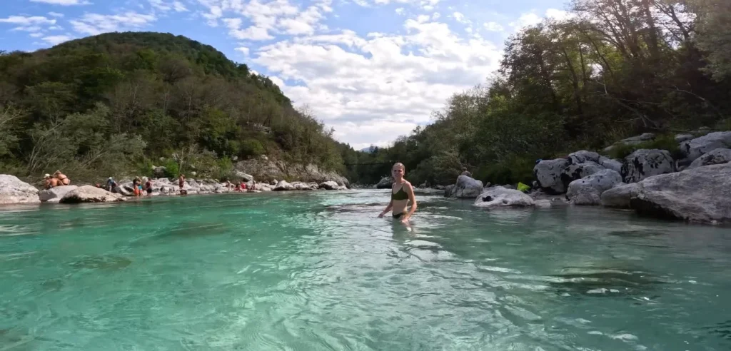
No one concerned me about the color. I had seen pictures, but I had thought they were airbrushed-that certain glacier melt-tropical lagoon blue-green. Then I drove to the Soica River with Kobarid and stood and looked at it at least one minute. It’s not edited. This water actually appears that way, all year round, due to the manner in which the limestone riverbed refracts light through the glacial sediment.
The Sooca Valley is approximately 96 km in length, which is on the west side of Julian Alps and up to the Italian border and may be the most desirable outdoor path in central Europe. Kayakers, rafters, fly fishermen, hikers, road cyclists all thronging the same slender stretch of valley. During summer the banks of the river are crowded with bathers. It behoveth better in autumn, when the crowds are thinned and the beech woods are orange.
Two stops you don’t skip:
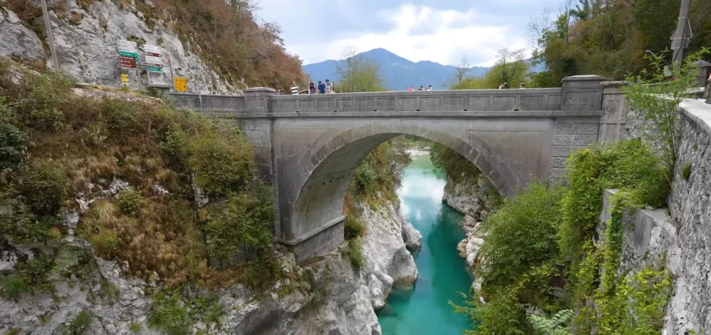
The Bridge (Napoleonov most) across Kobarid by Napoleon, a single arch of stone, dating to 1750, was rebuilt after the WWI. One of those angles, which do not require a filter, is to stand under it and look up through the arch at the Sooca. The Kobarid Museum is close, which records the Isonzo Front – 11 bloody combats that were fought in this valley in the year 1915-1917. Hemingway came past here. In 1993 the museum was awarded the Council of Europe Museum Prize.
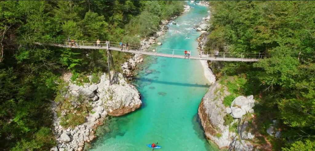
It is the Suspension Bridge across the Sooc, (aerial above) which shows the color of the Sooc most effectively, a kayaker who is going through the impossibly blue water under a slender footbridge. The centre of adventure sports is the town of Bovec: white-water rafting, canyoning, paragliding. A rafting adventure is about half a day and would cost 40-50 euro/per person per season.
Soča Valley at a Glance:
| Activity | Difficulty | Best Season | Approx. Cost |
| White-water rafting | Moderate | May–September | 40–50€ |
| Kayaking | Intermediate–Advanced | April–October | From 35€ |
| Fly fishing | All levels | March–October | License required |
| Hiking (Soča Trail) | Easy–Moderate | May–October | Free |
| Canyoning | Moderate | June–September | From 45€ |
One of the finest day hikes I have ever undertaken anywhere is the Soocay Trail, a 25km marked hiking trail along the river along the national park. You are strolling next to a river that varies in color with the light. Here and there are swaths of turquoise, here and there almost emerald. Took approximately 6 hours with breaks.
Triglav: Slovenia’s Mountain Soul
It is expected that every Slovenian should once in his life climb Triglav. It is not a tourism slogan, it is a real cultural expectation, a rite of passage. The mountain has been featured in the national flag, national coat of arms and quite frankly in nearly fifty percent of the conversations I had with locals. It is the tallest mountain in the nation and the heart of Triglav National Park, the only national park in Slovenia, 880 km² of the Julian Alps.
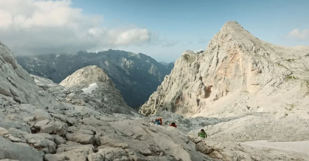
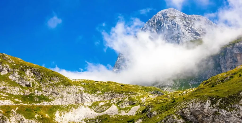
I did not climb to the Triglav summit – two-day technical climbing with steel cables in the upper part, the presence of a mountain hut overnight. And I came near enough. The Bohinj route puts you through some of the most ungroomed landscape that I have ever walked through. Limestone all over, the rock pale grey-white on a sunny day, the type of landscape you begin to realize why the early Slovenians placed a goddess in the mountain.
What I had done was to walk above the cloud line on a ridge just beyond Velika Planina– that picture of three hikers with the sea of cloud beneath them and peaks sticking up? That was at an approximate time of 6:30am and it took approximately 40 minutes before the cloud cleared. Worth the 5am alarm.
For those planning a Triglav attempt:
- Most common routes start from Bohinj (longer, more scenic) or Kranjska Gora (shorter, more technical).
- The climb requires basic mountaineering experience — fixed cables on the upper section but no ropes needed in summer.
- Mountain huts (planinske koče) must be booked in advance; the most popular, Dom Planika, sits at 2,401m.
- Best window: July to mid-September. Snow can close routes in June and again by October.
- The national park charges no entry fee but trail maintenance donations are encouraged.
Postojna Cave & Predjama Castle: Underground and Impossible
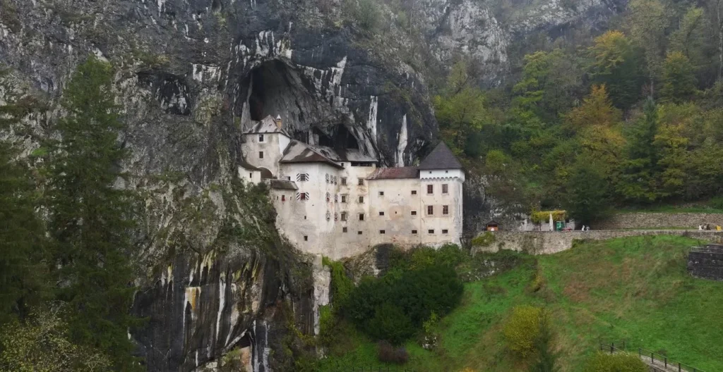
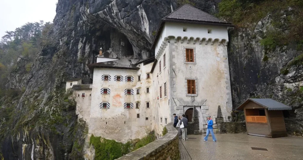
It is a castle constructed in a cave mouth in a side of a cliff. The sentence sounds like it is made up. Predjama Castle is not a fantasy, but a 12th century castle that has been constructed into a 123 meters karst cave hole in the Karst plateau, 9 km away, near Postojna and it ranks as the largest cave castle in the world according to Guinness World Records. The existing building was built in 1570. In a knight called Erazem Lueger seemingly defended a siege here more than a year, by a secret way through the cave system. He was then murdered- it is said when he was sitting in the outside toilet of the castle, a cannonball hit him. The past can be very exacting.
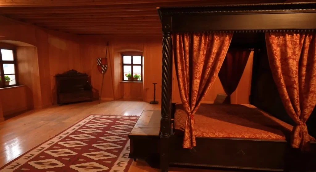
The rooms within are bare and gloomy: stone walls, boards on the floor, a four-poster bed covered with crimson cloth that has the appearance of having been in a Flemish picture. The castle was constructed partially within the cave such that some of the rooms literally have a cave ceiling overhead. It is dizzying, at best.
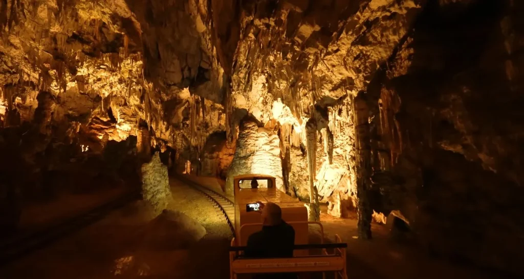
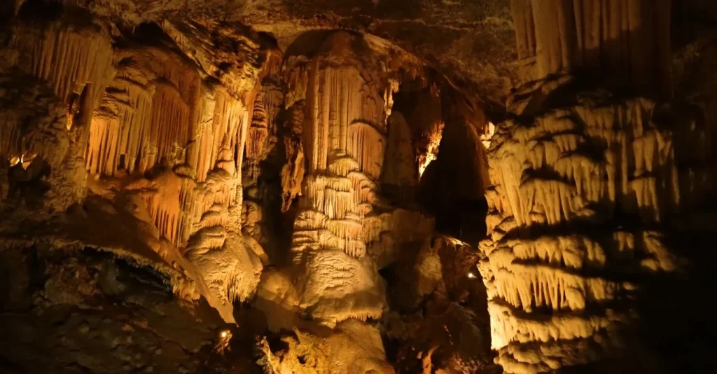
The nearest one is Postojna Cave 2km away and an entirely different experience. The cave system is 24 kilometers long – the second longest in Slovenia and one of the largest karst cave systems of the world. The first 3.7km is by electric train on a small train followed by walking the remaining. The stalactites and stalagmites are so big that the word impressive does not do justice to the term.
Olm (Proteus anguinus) is also found in the cave; a blind, pale salamander found only in Slovenian and Croatian caves and can survive without food up to 10 years. I had observed one longer than I am proud to say through the aquarium glass.
Visiting both in one day is easy:
- Postojna Cave tour: ~1.5 hours, runs every hour, book online at postojnska-jama.eu.
- Predjama Castle: 30–40 minutes, included in combo ticket.
- Combo adult ticket: approximately 38–42€ depending on season.
- Wear a jacket — cave temperature is a constant 10°C regardless of outside weather.
Piran & the Adriatic Coast: 47 Kilometers of Surprise
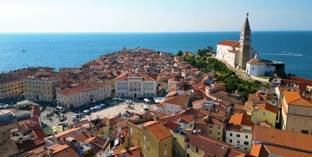
Slovenia has a 47 km long coastline. To put it into context, the length of Croatia is more than 1,700km. You would think it an afterthought–it is not. Where Slovenia is short, it all makes up in Piran, a Venetian port town of the middle ages that sticks out into the Adriatic sea on a small peninsula and appears, when viewed overhead, as though it could at any given moment slide down into the sea.
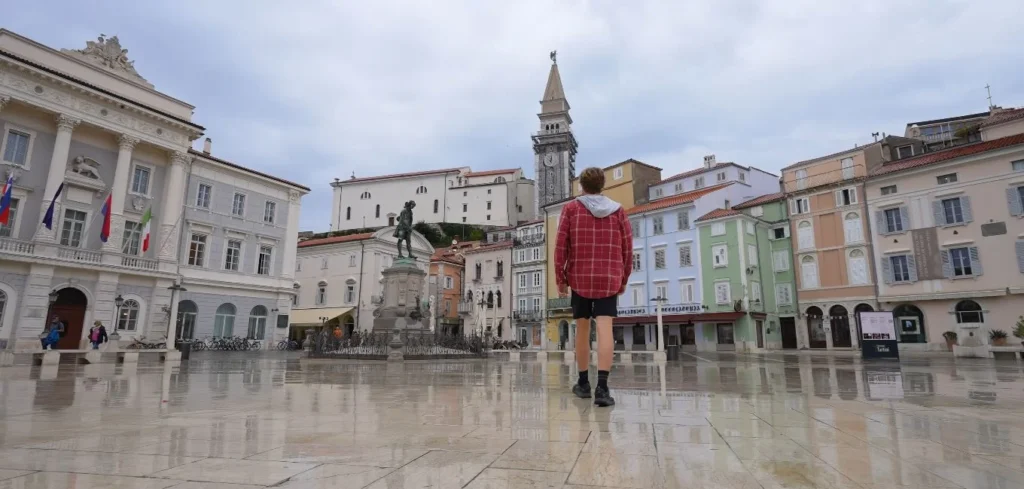
One grey morning I went into the Tartini Square–the marble still damp with the night rain and banging the pastel exteriors of the houses that surrounded it. Amidst the square, with a red flannel jacket and looking up at the bell tower of the Church of St. George, was a kid. Nobody else around. That picture got itself a permanent seat. This square commemorates the 18th century violinist and composer Giuseppe Tartini, born in Piran – a statue of him in the centre of the square gazes so solemnly.
The panorama of the city that is seen through the bell tower of St. George is worth the effort. The entire town is below you – terracotta roofs, the narrow medieval street pattern, the open Adriatic on three sides, a sailboat or two in the distance. On a clear day you can see the Italian coast.
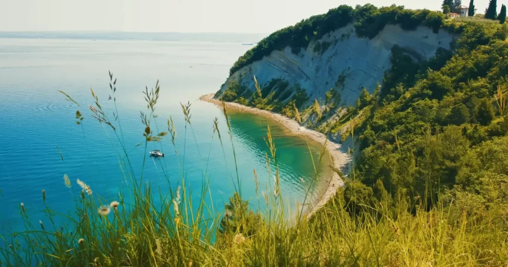
A couple of kilometers north is Strunjan – a nature reserve with white chalk cliffs falling directly down to a lee shore pebble-cove. One boat was on the water with the anchors out in the turquoise water, wild grass in the foreground, no one visible on the cliff path. It is the type of beach that recompenses individuals who do not stick to the tourist route.
Slovenian Coast Quick Reference:
| Town | Character | Don’t Miss |
| Piran | Medieval Venetian, compact | Tartini Square, bell tower view, old town walls |
| Portorož | Resort town, beaches | Forma Viva sculpture park |
| Koper | Working port, authentic | Cathedral Square, Loggia |
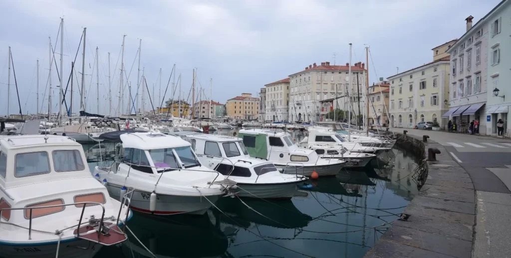
| Izola | Fishing town, laid-back | Harbor fish restaurants |
| Strunjan | Nature reserve | Cliff walk, Strunjan Bay |
Salt pans at SečovljeSalt pans at Sečovlje, a preserved landscape in the immediate south of Portorož, have been exploited since the 14th century. Still operating. Salt harvested here, the manufacture of fleur de sel is sold in restaurants of high quality in Europe. I bought a bag for about 4€ directly from the cooperative. It is in my kitchen at the moment.
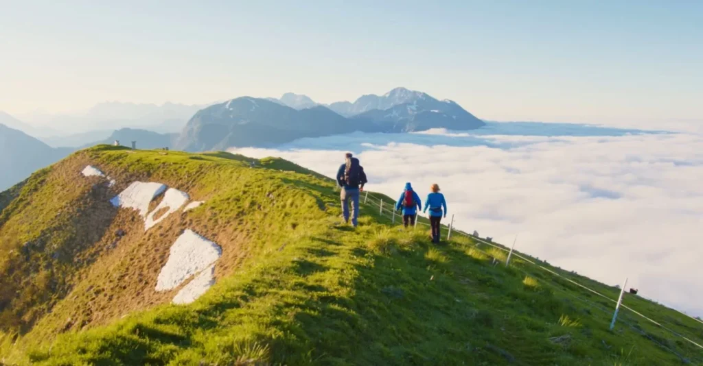
Velika Planina: The Shepherd Plateau That Stops Time
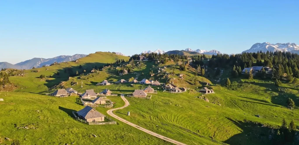
I nearly missed Velika Planina. It was not in my initial plan of action, a local I encountered at Ljubljana had brought it up nearly incidentally, like people do things that they think everyone already knows about. Velika Planina, you see, you are going to. I wasn’t. Changed that immediately.
Velika Planina is a high alpine zone of approximately 1,500 meters above sea level in Kamnik-Savinja Alps, which is approximately an hour south of Ljubljana. Shepherds have been taking cattle up here all through centuries–the earliest written laws date as far back as 1242–and the village of herders’ huts that covers the plateau is the biggest in Europe. Thatch, same weathered wood, paddock fences. It is as though it was an air creation of a fantasy novel.
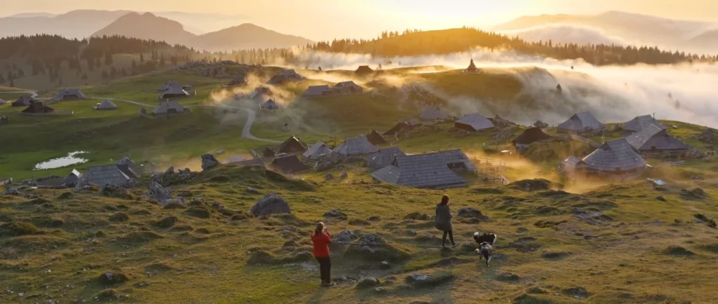
The dawn I snatched there was the one that spoils you. Fog in the valleys below, smouldering orange in the sun just above the ridgeline, the huts semi-obstructed by the fog drifting down the valleys, two figures walking a dog across the plateau with no special haste. I was watching it perhaps half an hour. Shot maybe 200 photos. Used three.
Getting there:
- Cable car from Kamnik runs year-round, about 14€ return.
- Or hike up — roughly 2.5 hours on a marked trail from Stahovica.
- The plateau is walkable in all directions; circumference loop takes about 2 hours.
- Small huts sell cheese, milk and kisla smetana (sour cream) made on-site from the summer cattle — buy some, eat it with bread, don’t argue.
Stay for sunset if you can. The light on those huts goes amber, then deep orange, then the whole plateau goes quiet in a way that cities never do.
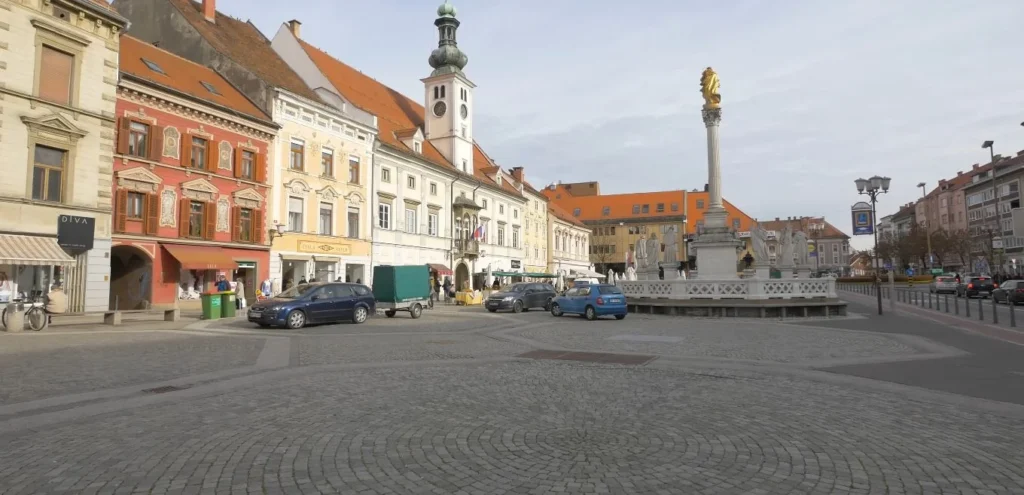
Maribor & Ptuj: Eastern Slovenia Does It’s Own Thing
Most visitors never make it east of Ljubljana. Their loss.
The second city in Slovenia is Maribor – the population is approximately 95,000, it has a university, a wine region (essentially on it’s doorstep) and the oldest known living grapevine in the world growing on the wall of a house in the old town. The Old Vine (Stara trta) is more than 400 years old and continues to bear grapes every harvest, appearing in the Guinness World Records. Each year they produce approximately 100 small bottles of wine most of which are diplomatic gifts.
The main square — Glavni trg is anchored by the Plague Column, a 17th-century pillar with a golden figure at the top that locals walk past every day without seeming to notice it. The baroque facades around it are well-worn rather than restored-to-death, which I prefer. The Lent district along the Drava river has bars, galleries and a summer festival in June that the whole city apparently empties into.
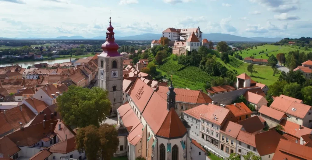
Ptuj is even older settled since the Stone Age, a Roman city (Poetovio) by the 1st century AD and by general consensus Slovenia’s oldest city. The castle sits on a low hill directly above the old town and is visible from half the surrounding plain. Walking up through the narrow streets below it on a quiet afternoon, past a 12th-century Dominican monastery and a Roman tower still standing in someone’s backyard essentially, it’s one of those places where the history isn’t curated into a visitor experience. It just exists, matter-of-factly, alongside the present.
Another well-known event in Ptuj is Kurentovanje, a centuries-old Shrovetide carnival, during which the participants wear sheepskin outfits with feathered headdresses and bells tied to their waist. In 2017, it was listed on the Intangible Cultural Heritage list by UNESCO. Don’t miss it when your dates are in line.
Before You Go: The Practical Stuff
This isn’t the kind of country that punishes you for being underprepared — Slovenians are helpful, most speak English and the infrastructure is solid. But a few things worth knowing:
Getting Around:
- Car is king outside Ljubljana. Trains connect major cities but miss most of the interesting countryside
- Highways require a vignette sticker (weekly ~16€, annual ~120€) buy it at the border or any petrol station before joining the motorway, the fines are steep
- Ljubljana’s old town is entirely walkable; everything else needs wheels
Money & Budget:
| Category | Budget | Mid-Range | Splurge |
| Accommodation (per night) | Hostel 20–35€ | Hotel 70–120€ | Boutique 150€+ |
| Food (per day) | 20–30€ | 40–60€ | 80€+ |
| Attractions | Most under 20€ | Combo tickets 35–45€ | — |
| Transport | Bus/train 5–15€ | Car hire from 35€/day | — |
Best Time to Visit:
- May–June: Everything green, before peak crowds, waterfalls at full flow.
- September–October: Harvest season, wine country comes alive, Bled without the summer chaos.
- December: Ljubljana’s Christmas market is genuinely one of Europe’s better ones — not just a tourist setup.
Some final notes: Slovenia uses the euro, tap water is superb, everywhere (some of the best in Europe in fact), tipping is not compulsory, but 10 per cent. in a restaurant would be nice. And when a neighbour asks you a shot of schnapps (žganje) in the forenoon just take it. Not all of the customs are worth disputing.