
I’d been looking at photos of Patagonia for three years before I finally went. Kept pushing it — too far, too expensive, too much planning. Then a friend who’d just come back said something that stuck: “The photos don’t do it any favors. It’s stranger than that.” Two weeks later I was booking flights to Buenos Aires.
He was right. Strange is the word.
Bariloche: The Argentina That Argentina forgot that it was Argentina
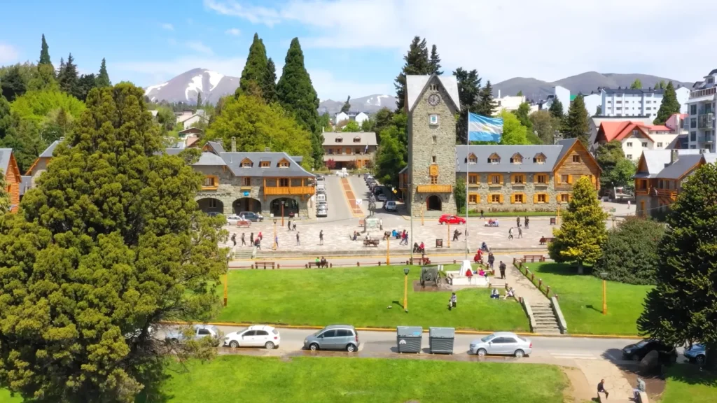
No one informs you that you will arrive in the town which resembles the Swiss Alps air-lifted and dropped at the shore of a lake in Patagonia. Bariloche occupies the Argentina Lake District, which is approximately 800 meters high supported by the Andes, with the front side facing Lago Nahuel Huapi. The stone clock tower in the civic center, constructed in 1930s by the German and Swiss immigrants actually left me confused at some point. The flag helped.
It is an actual city, not a tourist set stage. People here live, work here, debate over parking here. but the mountains in the background are solemn.
Cerro Catedral: Do Not Miss It to the Glacier
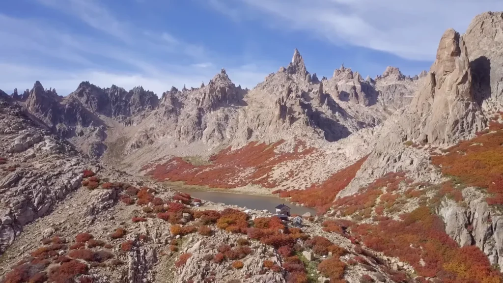
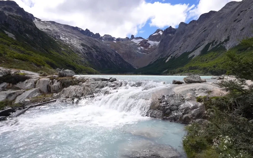
The majority of the population uses Bariloche as a stop-over on the southbound route. That’s a mistake. Cerro catedral- the largest ski resort in South America during winter seasons becomes virtually spooky during autumn. The lenga beech shrubs turn all deep red and orange in the boulder fields of the high altitudes and there is a little refugio by the side of a glacial tarn, which are filled by granite needles that look not like anything I had ever seen. It took me about four hours of hiking up. The final one is scree and light scrambling. Worth it.
Quick Bariloche Logistics:
- Fly to Bariloche Airport (BRC) it has direct flights with Buenos Aires (Aerolineas Argentinas, LATAM).
- Most desirable base: the Villa la Angostura or the city center in case you would prefer quieter.
- Season: November-March to go hiking; July-September to go skiing.
- Don’t leave without trying the local craft chocolate — the Swiss influence is real here.
El Calafate: A Town That Exists Because of One Glacier
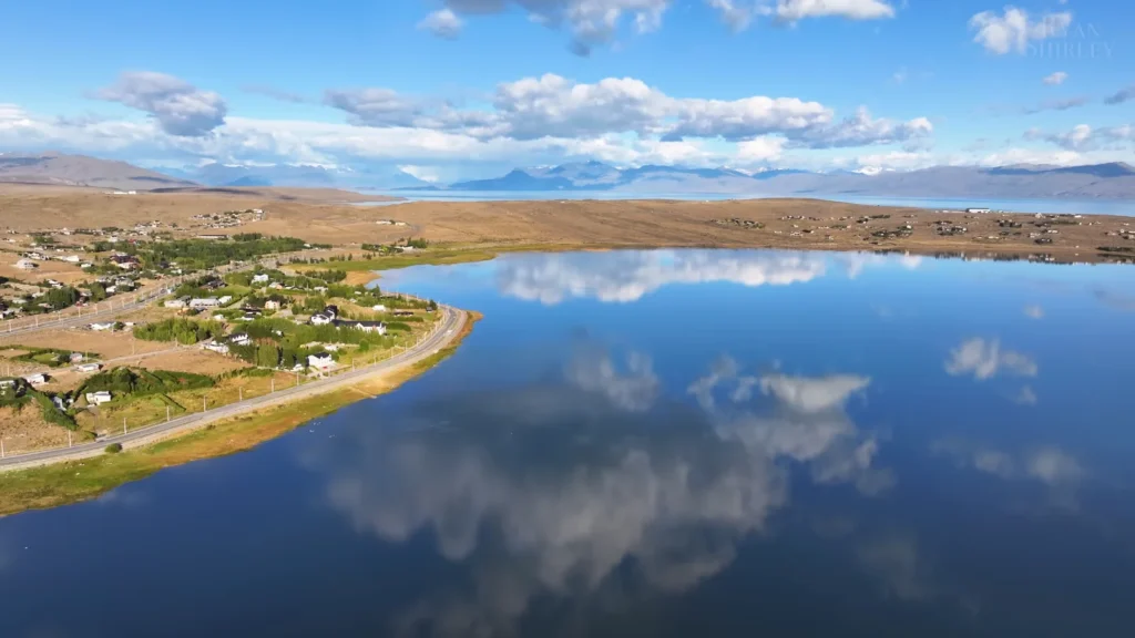
El Calafate is approximately 2,700km south of Buenos Aires. The journey lasts about three hours and the change of scenery is instantaneous flat steppe, brown, gold, all the way to mountains on each horizon. The town, in fact, is small, tourist-based and developed, wholly around a single thing: Perito Moreno Glacier.
Take half an hour to drive out of town and you will begin to see guanacos. Scores of them, simply standing on the steppe in the same way they own it, which, to be truthful, they do. I pulled over three times. By the third counting I had ceased.
Perito Moreno: 60 Meters of Ice and Then the Sound
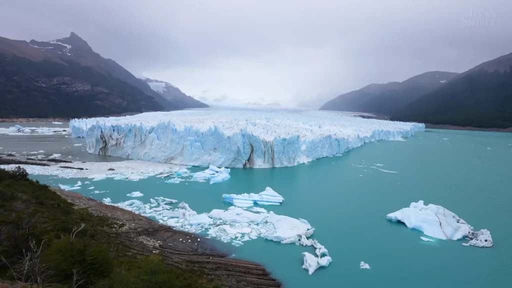
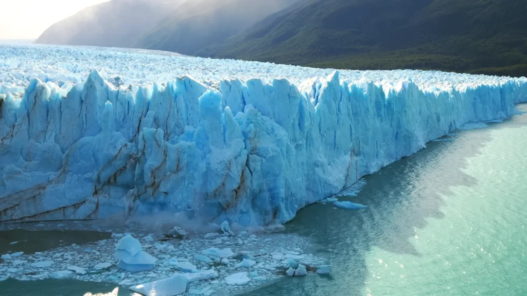
This is what is not captured in the photos: the sound. Perito Moreno is one of the few advancing glaciers in the world as opposed to the receding ones. It is about 5 km across the face and is 60 meters above the lake surface – that is to say another 120 or so is under the and at an interval of about 20 minutes or so a piece of it is peeling away and falling on the water with a sound that is not a splash, but a kind of controlled demolition.waterline. As you stand on the boardwalks you can hear the cracking, like shots of rifles at great distance,
I waited two hours for a major calving event. Got a medium one. Still jaw-dropping.
| Feature | Detail |
| Width of glacier face | ~5 km |
| Height above water | ~60 meters |
| Total ice depth | ~170 meters |
| Park entrance fee | ~ARS 7,000 (approx. USD 8–10) |
| Best viewing time | Morning light, arrive early |
Getting There: Day trips from El Calafate run about USD 30–50 through most local agencies. Alternatively, rent a car — the drive along Ruta 11 through the steppe is worth doing slowly.
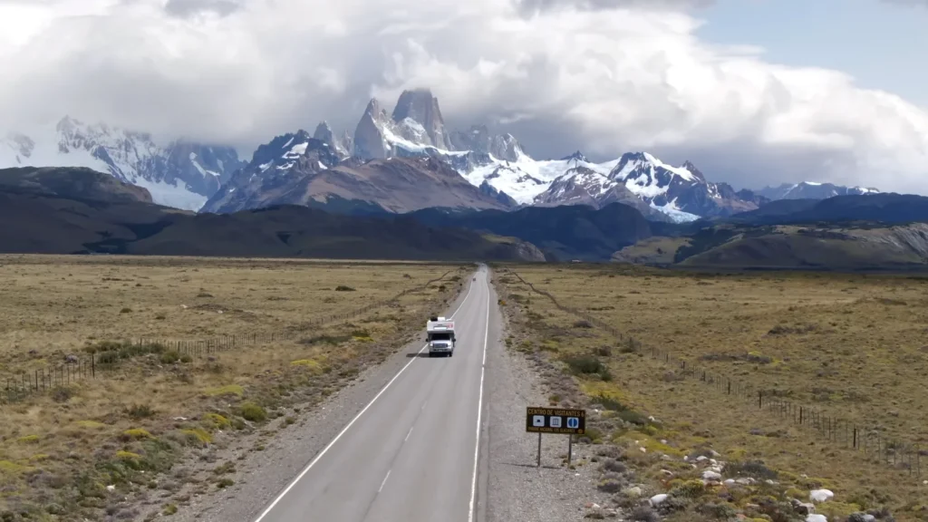
El Chaltén: The Town That’s Basically a Trailhead
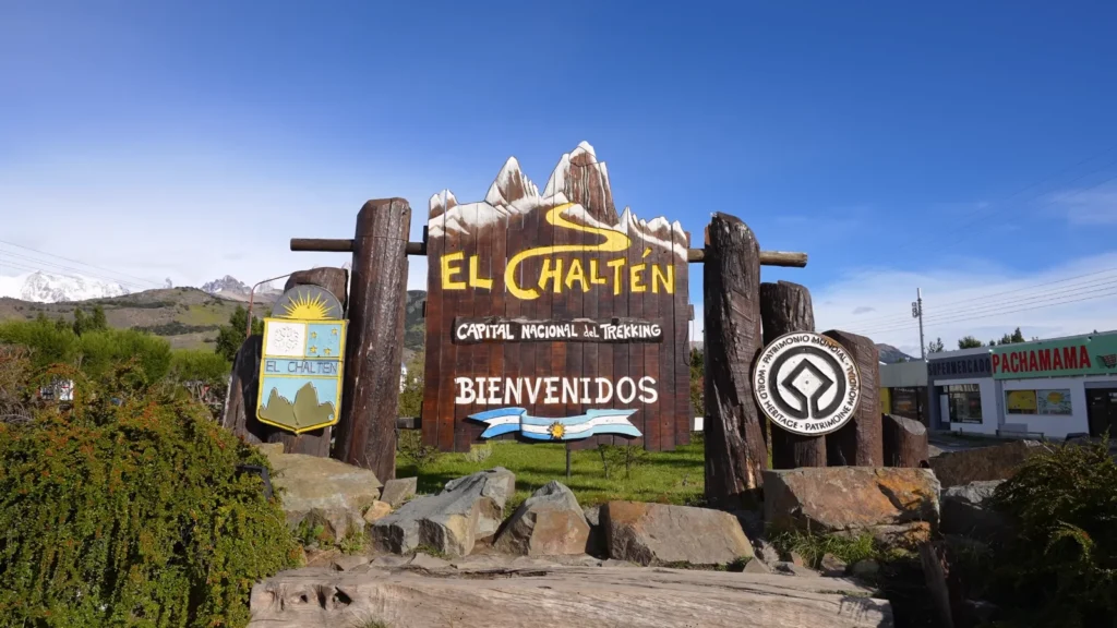
Population: roughly 1,500 permanent residents. Founded in 1985, specifically so Argentina could assert territorial claim over this corner of the Andes before Chile did. The town sign calls it the Capital Nacional del Trekking and that’s not marketing — every single trail here starts from within walking distance of the main street.
That street-level shot I took my first morning here — just a quiet road, some shops and then Fitz Roy’s granite needles sitting at the end of it like a backdrop that someone forgot to take down. I stood there for a while. Just stood there.
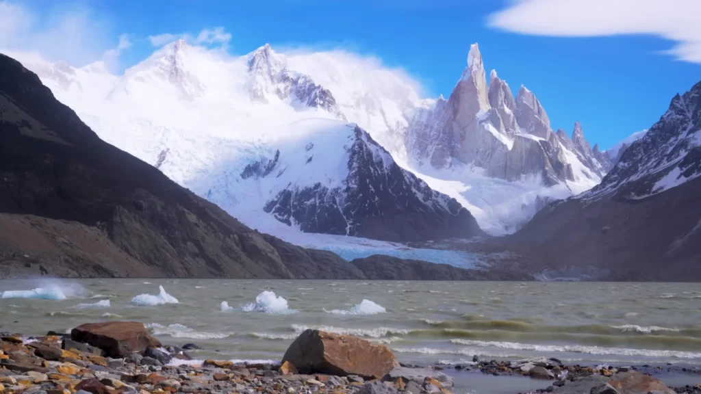
Fitz Roy: The Hike to Laguna de Los Tres

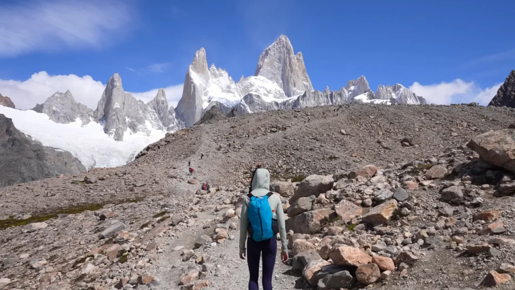
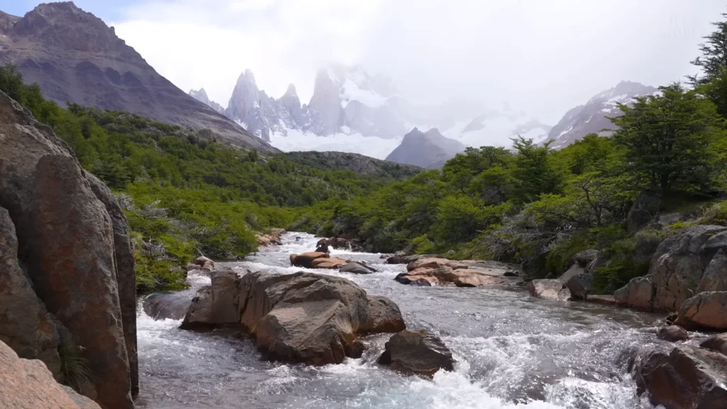
The most prominent hike is Laguna de Los tres. The distance is approximately 22 km round trip and the uphill distance is 1,200 meters and the final 45 minute is loose scree with steep slopes making your legs jelly. On the right: a turquoise lake directly under the vertical east face of Fitz Roy, whose elevation is 3, 405 meters. It had been all cloud socked at the summit all morning. I was waiting, eating a sandwich which I had slightly crushed. Then the clouds parted down with a very precise eight minutes. Eight minutes of such a countenance, all in full clarification.
Worth the scree. Worth all of it.
What to Know Before You Hike:
- No permit needed for day hikes — but register at the visitor center.
- Trails are free and well-marked.
- Laguna Torre is the quieter alternative — 18 km round trip, ends at Cerro Torre’s lakeside with floating ice.
- Wind picks up fast in the afternoon — start early, always.
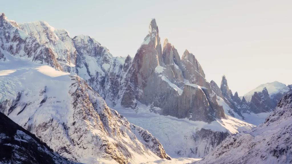
Cerro Torre at dusk — that gold light hitting the needle while the lake below is grey and choppy and cold — that’s the image I keep coming back to. Not Fitz Roy. Cerro Torre.
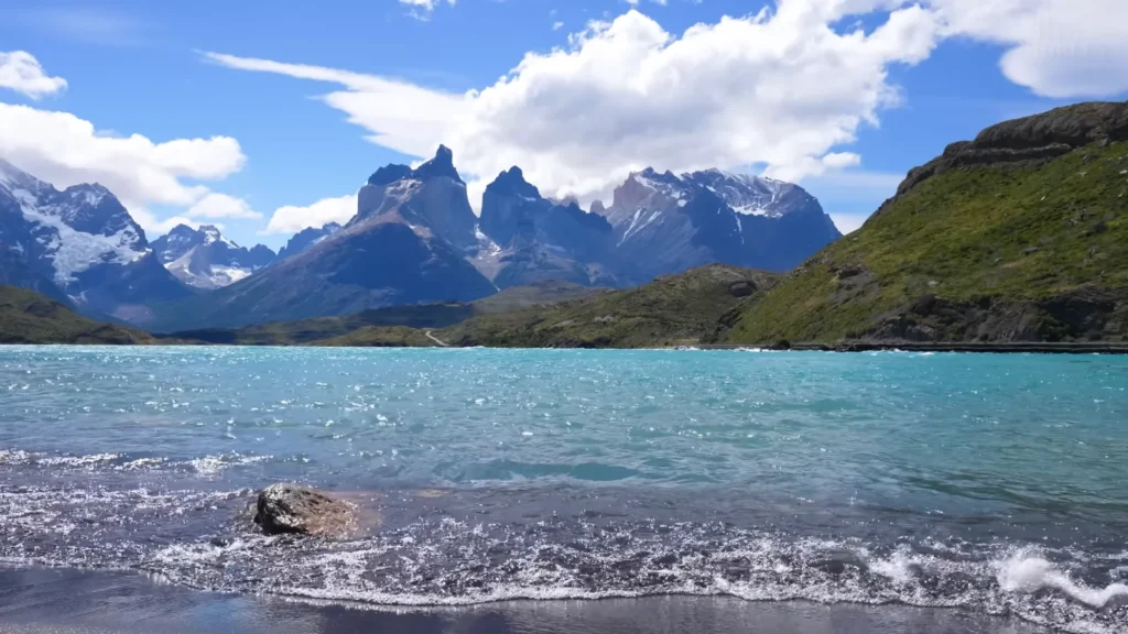
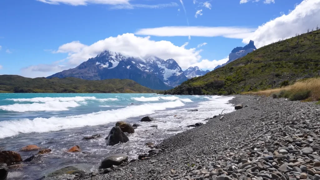
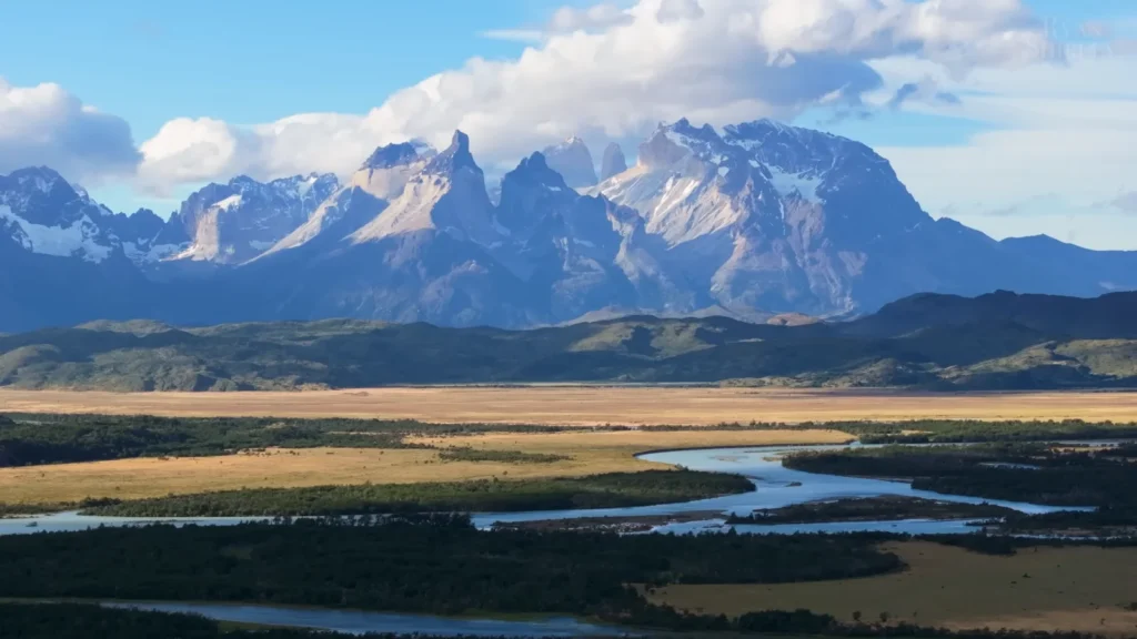
Torres del Paine: The One That Earns It’s Reputation

I’ll be honest — I was slightly skeptical about Torres del Paine before I went. It’s everywhere. Every travel Instagram, every South America bucket list, every “best places before you die” article written by someone who probably went once in 2019. When a place gets that saturated, you start wondering if the actual thing can keep up with the mythology around it.
It can. Annoying as that is to admit.
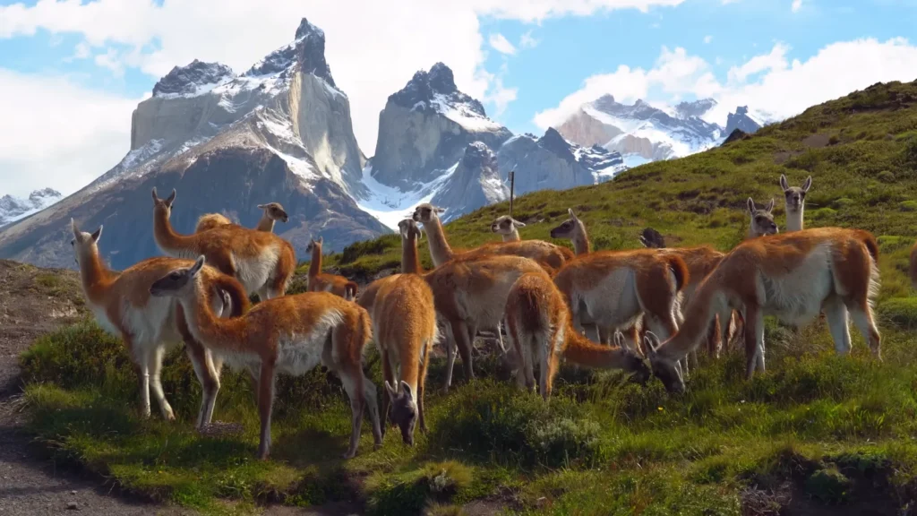
The park occupies the Patagonia region of Chile, some 112km north of the city of Puerto Natales and it comprises of approximately 242,000 hectares of glaciers, lakes, steppe and granite features that all appear distinctly alien. The Cuernos del Paine, these horn-shaped mountains twisted on themselves, are comprised of two totally distinct types of rocks welded together and this is why the peaks appear dark and banded at the top and pale granite at the bottom. This was never the case with geology class.
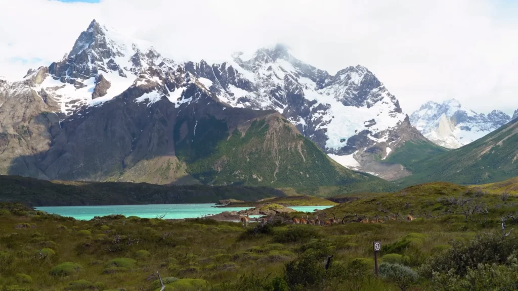
The guanacos here have got a point. They graze within three meters of the road and they are absolutely untroubled showing the Cuernos standing behind them like a painted background. One evening I saw a group of perhaps fifteen Crossing a hill-side, with two condors flying over their heads. Nobody was rushing anywhere.
Mirador Base Las Torres: The Hike Everyone Does and Why That’s Fine
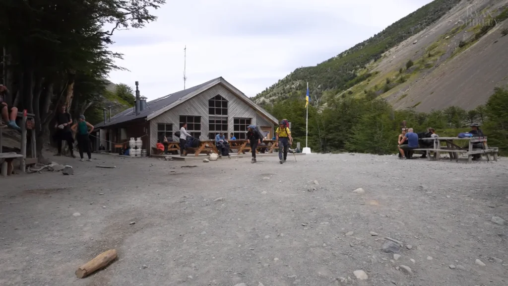
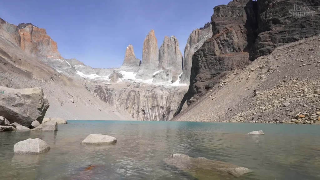
The road leading to the bottom of the towers is approximately 18-19 km both ways off Hosteria Las Torres. It is not technical, no scrambling, no ropes — but the final part is an enduring climb of loose rock which leaves something out of you. Two-thirds the way up the refugio is where half the hikers on the trail sit outside eating all that they packed, sore in the legs, re-evaluating their life decisions.
then as you rise the ridge there it is. The three towers, Paine Grande, Torre Central and Torre Sur, which tower directly out of a glacial cirque, whose reflection lies in the milky turquoise water below. The lake is too cold that people do not swim in it. One made an attempt during my visit. He kept a score of forty seconds.
I have seen this photograph several times that I believed it would be anticlimactic to look at the original photo. It didn’t.
Torres del Paine Trail Comparison:
| Trail | Distance (RT) | Difficulty | Highlights |
| Mirador Base Las Torres | 18–19 km | Moderate-Hard | The towers, glacial tarn |
| Valle del Francés | 20 km | Moderate | Hanging glacier, condors |
| Lago Grey | 22 km | Moderate | Grey Glacier views |
| W Trek (full) | ~80 km | Hard | All of the above, multi-day |
Park Logistics:
- Entry fee: approximately USD 21,000 CLP (roughly USD 25) per person.
- Book campsites and refugios months ahead — serious backlog November through February.
- CONAF controls all permits; no walk-ins for camping in peak season.
- Base yourself in Puerto Natales if budget-conscious; park lodges if not.
The Pumas
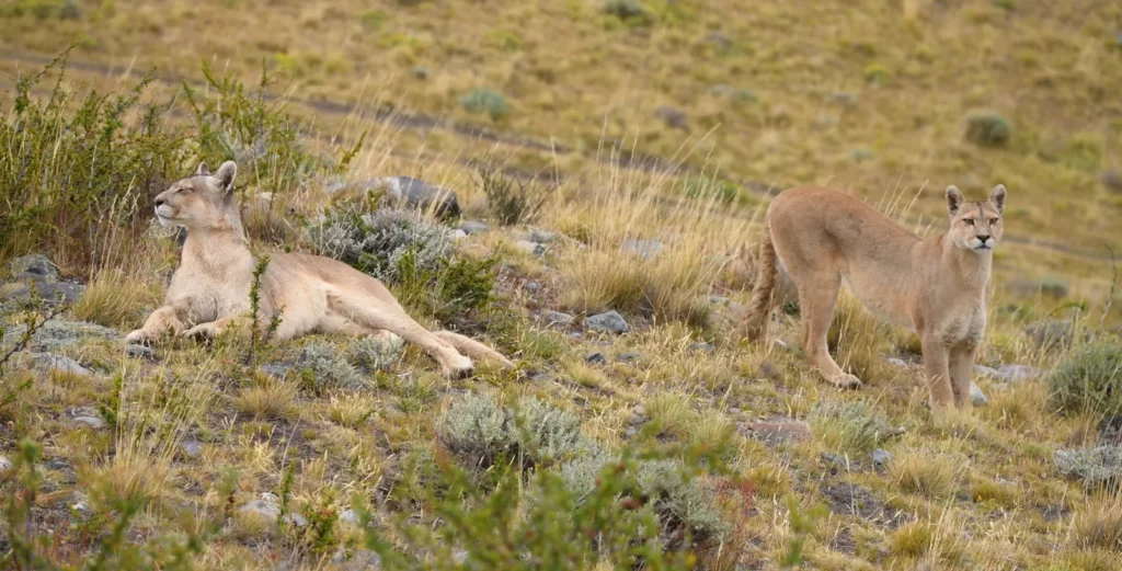
I must discuss this individually as it should have it’s own time.
Torres del Paine is a healthy population of pumas – perhaps 30-40 in the park. Most visitors never see one. I put out twice in the morning with a guide, who was a man of the place, called Rodrigo and had been following the same family three seasons. On the second morning, at about 7 AM, we discovered them on a hill-side with rocks and a view of the steppe. Forty meters distant, two adults, perfectly at their ease. One of them was lying down with half-closed eyes. The other rose to his feet and gazed long, ten seconds, directly at us and then sat down.
Rodrigo said he had done it about 200 times and it shook his hands yet. Mine too.
Ushuaia: The End of the World Is Louder Than You’d Think
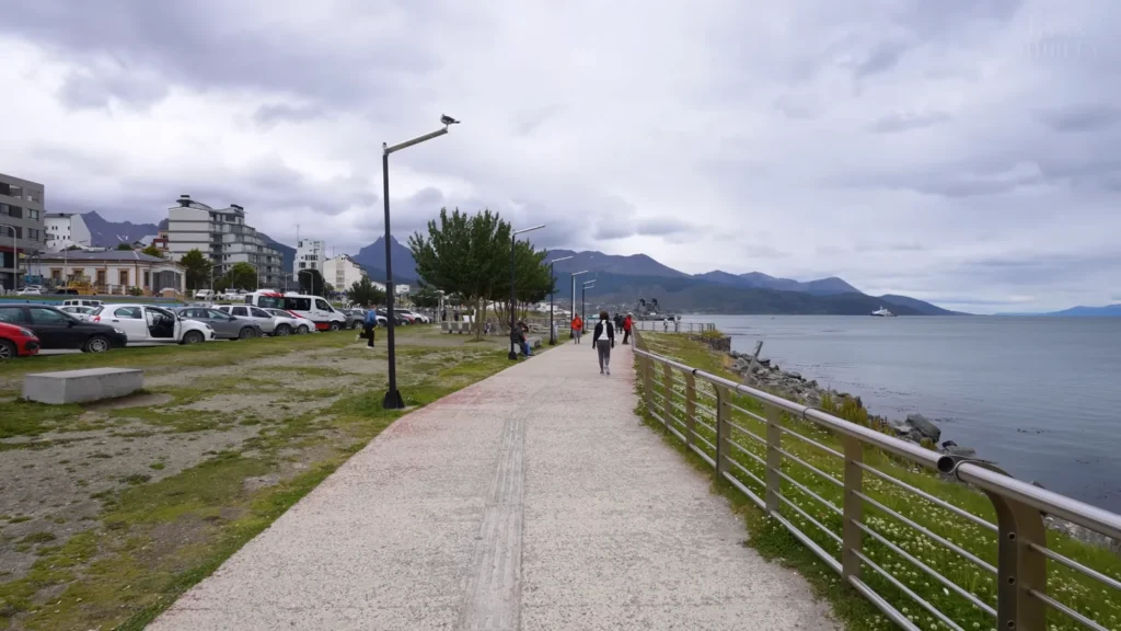
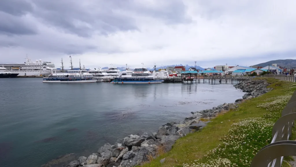
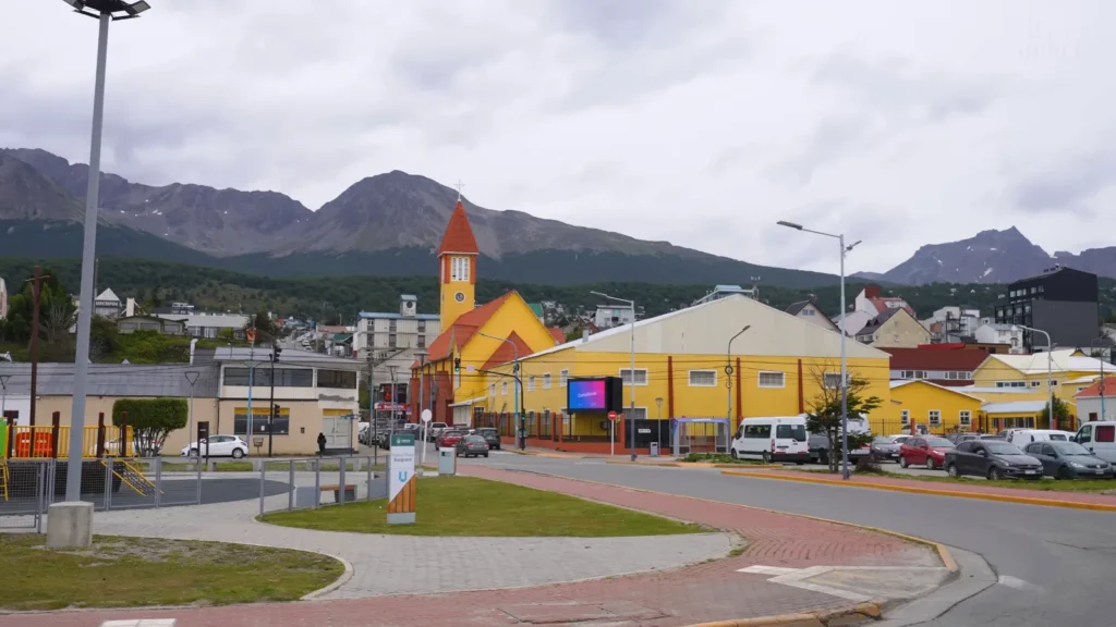
Ushuaia is positioned as the most southern city in the world, aggressive marketing, the signs, the post cards, the names of the restaurants, everything like that. And it is actually very south. 5448S, Beagle Channel out in front of it, the Martial Range at the back of it, Antarctica another 1,000km away. The harbour is never idle, the expedition boats loading to make the crossings, the catamaran boats on their way to penguin colonies on Isla Martillo, supply boats, fishing trawlers.
This town is not as pleasant as the brochures make it sound. Houses of coloured corrugated-iron ascending the hill, permanence of the wind, which blows off the channel, the nature of the light in December that remains until half-past 11 PM and leaves you as unoriented as ever. To my surprise I actually preferred the scratchiness.
The Tierra del Fuego National Park
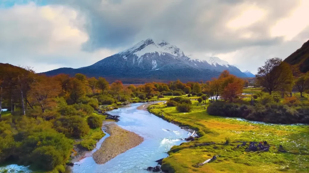
The Tierra del Fuego national park is the only national park to possess a coastline on the Beagle channel and is located about 12 km west of Ushuaia. It is also the place where the Pan-American Highway technically terminates, as there is a small sign to show that it was technically ending, but the highway ceased to be passable several hundred kilometers further north.
Autumn in the park is something different. Lenga beech turns deep amber and copper in March-April and the contrast of that colour against the grey skies and snow-white tops is literally difficult to capture in the correct way, as nothing looks as saturated in the real world as it does.
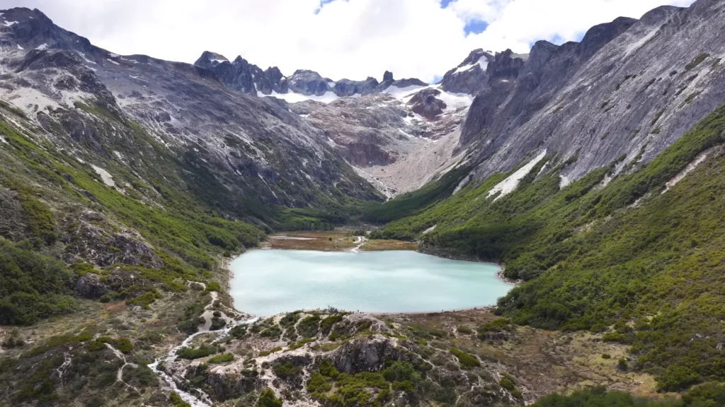
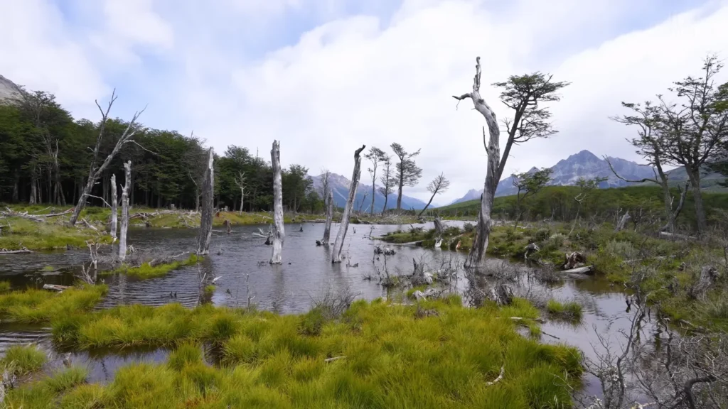
Staying within the town, Laguna Esmeralda is a 12 km round trip trail. The lake, itself, turquoise, glacier-fed and occupying a typical U-shaped valley, is the obvious destination. What I had not expected, however, was the damage caused by beavers on the road. In 1946, beavers of Canada were introduced to the Tierra del Fuego as a fur trade. The trade broke; the beavers remained and increased to tens of thousands. They have cut and drowned large parts of wood. The outcome is this weird, silent cemetery of bleached dead trunks that all stand in still water, which is ecologically disastrous and aesthetically dissimilar to any other thing that I have ever viewed in Patagonia.
The Marble Caves: The One that People Have Missed
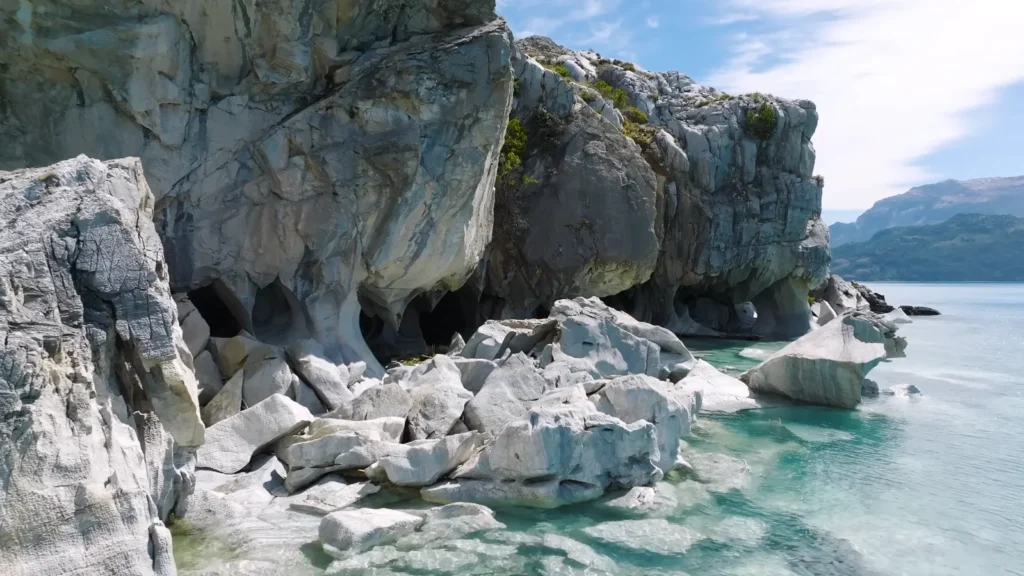
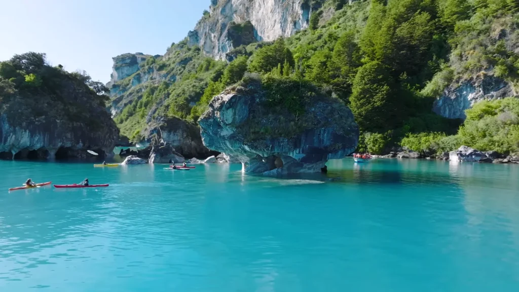
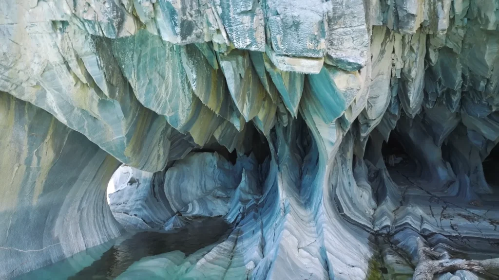
Cuevas de Mármol is located on the Chilean side of the Lago General Carrera- the second-largest lake in South America which cuts across the Argentina-Chile border. The half the story is getting there. Out of El Chaltén, it is quite a long drive north along Ruta 40, the type of landscape that causes you to keep looking at the fuel gauge after every 40 minutes because you really do not know of another gas station.
The caves are made of solid marble, which has been carved in 6,000 years because of the lake waves. The colour of the lake, the mad electric turquoise, created by glacial flour in the water, replicates up into the ceilings of the caves and changes with the light. Blue-green and white and deep teal. We went by kayak. The pathway led us into a tunnel which was perhaps three meters across and the marble above swirled in patterns which showed to be hand-drawn. It wasn’t loud or dramatic. It was simply very, very beautiful in a quiet manner.
This is omitted in most itineraries of Patagonia. The Patagonia itineraries are mostly erroneous.
The Fjords: What You See From the Water
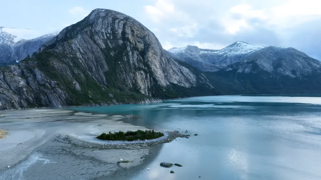
The fjords of Patagonia, along the coast of Chile between Puerto Montt and Cape Horn, can only be visited by the Navimag ferry a cargo-passenger ship that takes four days to travel between Puerto Montt and Puerto Natales traveling along the channels which are not yet completely charted even with the help of GPS. In the plane, I came across a German couple who had booked it just because they wanted four days without the phone. That worked out.
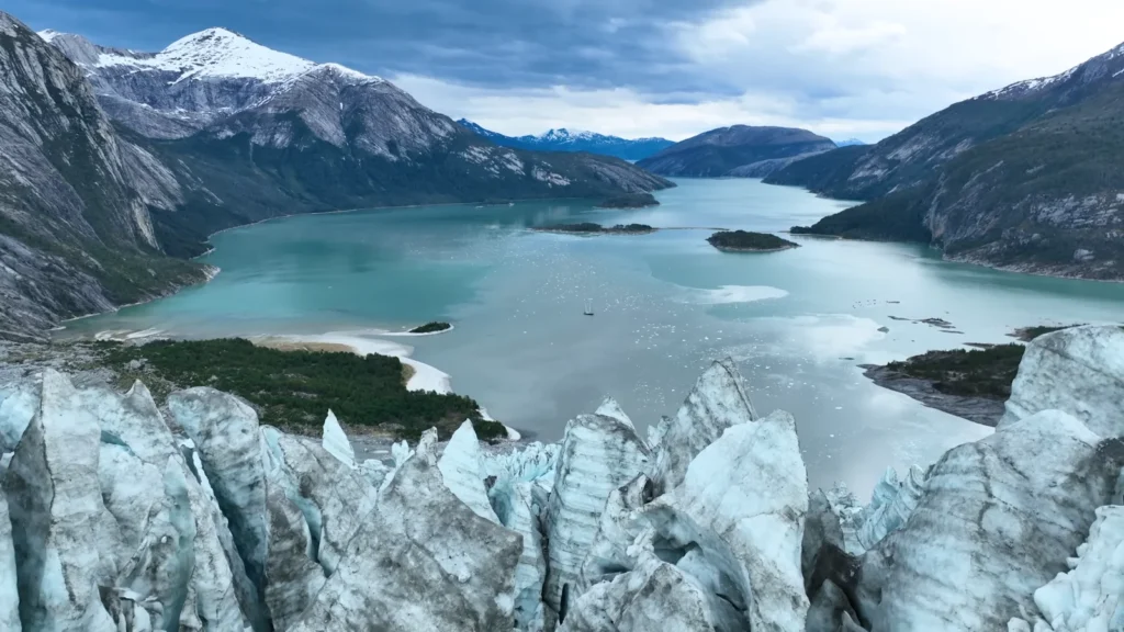
The glacier-top view — standing on the ice looking down over a milky turquoise fjord while a small sailboat sat anchored below us like a toy — is the image I come back to most. Nobody else was on that section of ice. Wind, ice, water, one sailboat. That was it.
Planning the Trip: What Actually Matters
Here’s the thing nobody tells you when you start researching Patagonia: the planning is almost as overwhelming as the place itself. Routes, borders, ferry schedules, park permits that sell out in February for the following November — it’s a lot. I spent about three weeks just figuring out the logistics before I booked anything. So let me save you some of that.
When to Go — And What “Good Weather” Actually Means Here
Patagonia doesn’t really do predictable weather. I talked to a ranger in Torres del Paine who’d worked there eleven years and he said, perfectly seriously, that he’d seen all four seasons in a single afternoon. That’s not a joke. It’s not even unusual.
That said, the windows do matter.
| Season | Months | Conditions | Best For |
| Peak Summer | Dec – Feb | Warmest, windiest, most crowded | Hiking, long daylight |
| Shoulder | Nov & Mar | Calmer winds, fewer people, variable | Everything — best overall |
| Autumn | Apr – May | Stunning colour, cold nights | Photography, quiet trails |
| Winter | Jun – Aug | Harsh, many closures | Skiing Bariloche, puma sightings |
November and March are the months I’d push most people toward. The crowds thin out noticeably — not completely, but enough that you’re not queuing for a viewpoint. The light in March especially, with the lenga beech starting to turn, is the kind of thing that makes photographers book return trips.
One of the facts to remember: the wind in southern Patagonia peaks in January and December. El Chaltén and Torres del Paine are both located in the wind passes which blows off the Southern Ocean in the form of Westerlies. On one day in El Chaltén, there were constant gusts of approximately 100 km/h. Trails closed. All spent half a day together in two cafes. It happens.
The Route Question: Argentina, Chile or Both?
Patagonia borders two countries and the practical aspect of that fact are more than they might appear to.
The Classic Northern-to-Southern Route:
- Bariloche (Argentina) → fly or bus south.
- El Calafate (Argentina) → Perito Moreno base.
- El Chaltén (Argentina) → 3–4 days minimum, more if weather’s bad.
- Puerto Natales (Chile) → Torres del Paine gateway.
- Torres del Paine (Chile) → 3–5 days depending on trek.
- Ushuaia (Argentina) → fly in or bus from Punta Arenas.
The crossing of Argentina and Chile via this area is normally easy; the primary one that is used in the El Calafate to Puerto Natales route being Paso Rio Don Guillermo, yet the custom is tough on fresh goods. No fruit, no meat, no cattle on this side. At that crossing I lost a very good empanada and I have not yet come to terms with it.
If you’re adding the Marble Caves:
It means a diversion to the north along Ruta 40 or the Carretera Austral in Chile. Practical, although it will require at least 3 days and some truly distant driving. Rent a proper 4WD. Not negotiable.
Budget Breakdown: What It Actually Costs
Patagonia is a brand known to be costly. It is -but not so much as people would think if you arrange it. The expenses are hoarded in certain locations: park passes, lodging during the high season and domestic flights.
Estimated Daily Budgets (USD per person):
| Travel Style | Daily Cost | Notes |
| Budget (camping, cooking) | USD 60–90 | Requires own gear, advance planning |
| Mid-range (hostels, some restaurants) | USD 120–180 | Most common for independent travelers |
| Comfort (lodges, guided hikes) | USD 250–400+ | Explora/EcoCamp territory |
Special Costs to be Acquainted with:
- Torres del Paine national park entrance -estimated USD 25 per head.
- Perito Moreno day trip, El Calafate USD 3050.
- Navimag ferry Puerto Montt to Puerto Natales – USD 350 -700 with cabin.
- Marble Caves boat tour out of Chile Chico- USD 25-40 or so.
- Puma tracking tour, Torres del Paine USD 80-150.
Within Argentina, domestic flights can be oddly affordable when they are booked ahead of time by means of Aerolíneas Argentinas or LATAM. Buenos Aires to Bariloche or El Calafate usually costs USD 80-150 per way and should be booked a few months before taking this trip.
What to Pack: The Short Version
Patagonia packing lists online tend to run about 2,000 words. I’ll spare you that.
The non-negotiables:
- Hardshell jacket — waterproof, windproof, not negotiable.
- Merino wool base layers — worth the money.
- Trekking poles — that Torres del Paine scree is no joke.
- Sunscreen — the UV at altitude and latitude here is brutal even on cloudy days.
- Cash in both Argentine pesos and Chilean pesos — ATMs exist but they’re scarce in small towns.
- A physical map or downloaded offline maps — signal disappears fast once you leave the main towns.
One thing I wish someone had told me: bring more memory cards than you think you’ll need. I ran out on day nine.
Getting Around: Practical Reality
Within Argentina:
- Bus Sur and Andesmar run long-distance routes.
- El Chaltén is 3 hours from El Calafate by bus — Caltur and Chaltén Travel run daily services.
- Renting a car gives freedom but Ruta 40 sections are unpaved gravel — check your rental agreement covers it.
Within Chile:
- Bus Fernández and Bus Gomez cover Puerto Natales to Punta Arenas.
- Park shuttles inside Torres del Paine run on schedules — download them in advance, they change seasonally.
What Patagonia Actually Does to You
I keep trying to explain Patagonia to people who haven’t been and landing somewhere unsatisfying. The usual words — dramatic, remote, vast — don’t quite get there. It’s not that they’re wrong. It’s that they miss the texture of the thing.
What I remember most isn’t actually the big moments. Not the calving glacier or the pumas or that eight-minute window when Fitz Roy cleared. It’s smaller than that. It’s the weight of the wind on day three in El Chaltén. The specific cold of a glacial lake when you dip your hand in. The way a guanaco will stop, look at you with absolute disinterest and go back to eating. The silence inside the marble caves when the kayak stopped moving.
Patagonia does not act in your favor. There it is, as it has always been, running on that timescale, in which two weeks travelling will seem like a very long blink. It is not humiliating the wrong way. It’s clarifying.
Go in November if you can. Allow yourself more time than you imagine you are going to need. Book the glacier and then nothing. And to the Marble Caves– bid go. Diversion everything that you must divert.
One Last Thing About the Route
When you are covering all the sites of interest Bariloche, El Calafate, El Chaltén, Torres del Paine, Ushuaia, Marble Caves, fjords, etc. then you need at least 3 weeks. In reality three and a half. Two weeks make decisions, decisions that are painful.
My suggestion when time would be limited: forsake Bariloche (reserve it, it warrants) and shorten the Lake District bit. El Chalthen is a better choice than El Calafate when you are a hiker, Perito Moreno is a day trip that is out of this world but El Chalten requires three days to give it justice.
And that some one that tells you that the Marble Caves are not worth the timeing does not mean it has been.