
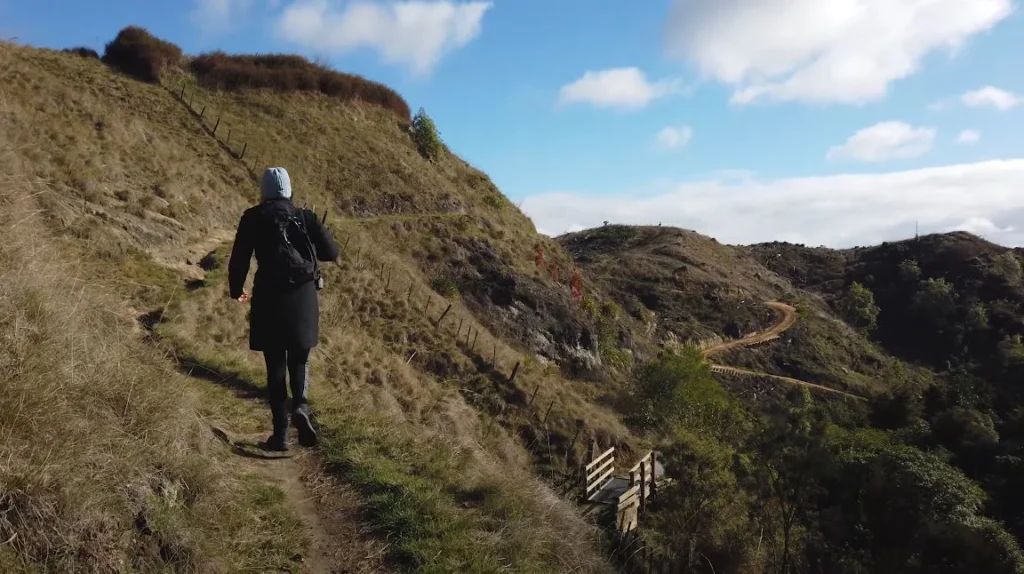
I’ve driven a lot of roads. Coastal motorways in Portugal, mountain-passes in Switzerland, interminable distances in the Australian outback. Something about the North Island of New Zealand, however, strike different. Perhaps it is the way the scenery continues to change on you every minute you are riding through farmlands that are even greener than fake and then the next minute you are looking at the turquoise water jumping out of volcano rock.
This one was the trip that saw me leave the weirdness of geothermal found in the Rotorua area downwards taking me through Taupo and finally to Napier at the east coast. Three hundred kilometers in three days, and frankly? I could have spent a week.
Starting Point: The Redwoods and Getting Into the Rhythm
I started off at Rotorua not because I had any grand scheme in mind but because I had heard about the Redwoods Treewalk and I was curious to find out what was all about. Even the forest is almost foreign to this place, being 120-year-old California redwoods which were planted by the New Zealand Forest Service in 1901. As though somebody pasted a piece of Northern California in the center of the North Island.
The treewalk consists of 700 metres of suspension bridges that join 27 platforms that are encircled by these huge trees. You are 9 to 20 metres above the forest floor, and it sounds horrifying, but not. The bridges sway a little. That’s about it.
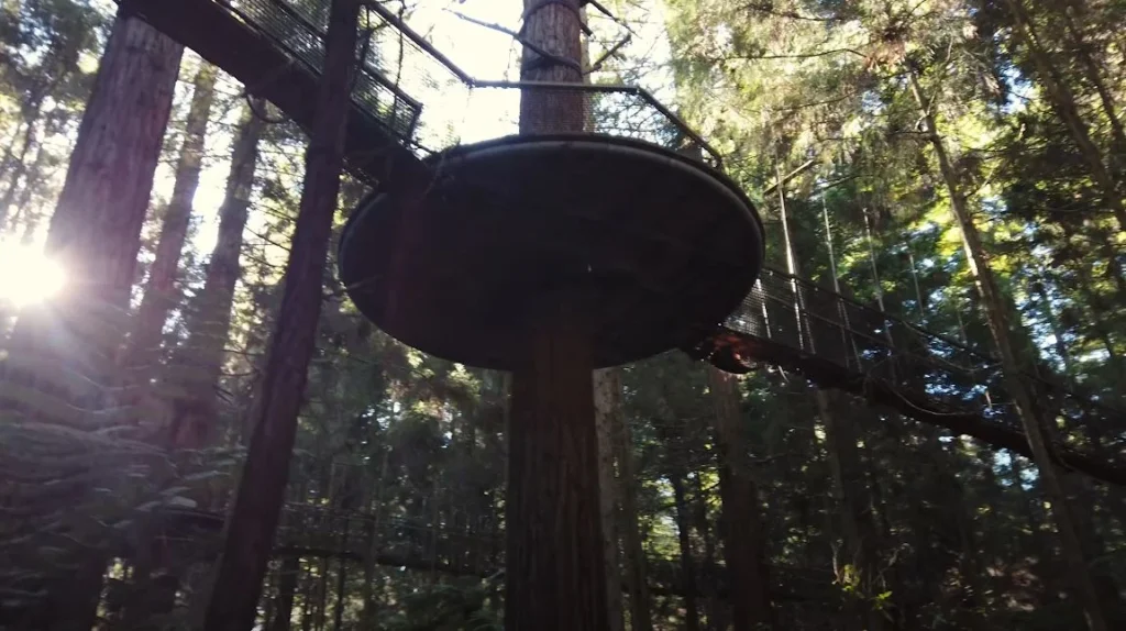
The things that fascinated me were these weird disc shapes that hung among the trees (created by artist David Trubridge) and that seemed to be between 2.5 metres high. At daytime they resemble UFOs who have lost their positions. They light at night with this airy light which changes the entire forest.
Worth the stop? Absolutely. It took me approximately 40 minutes and I was not in a hurry.
Huka Falls: It is Not the Length That Makes You Tall
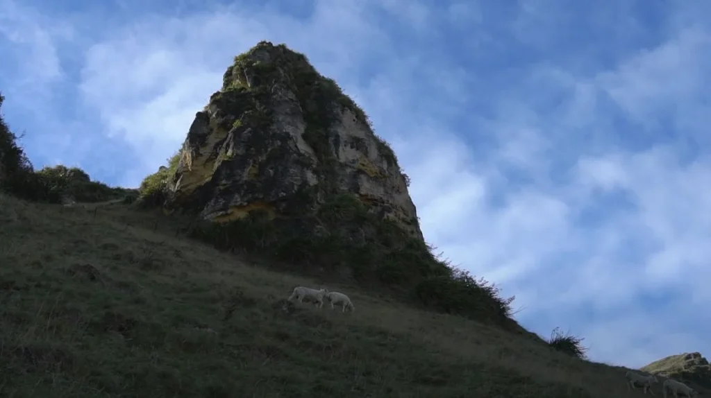
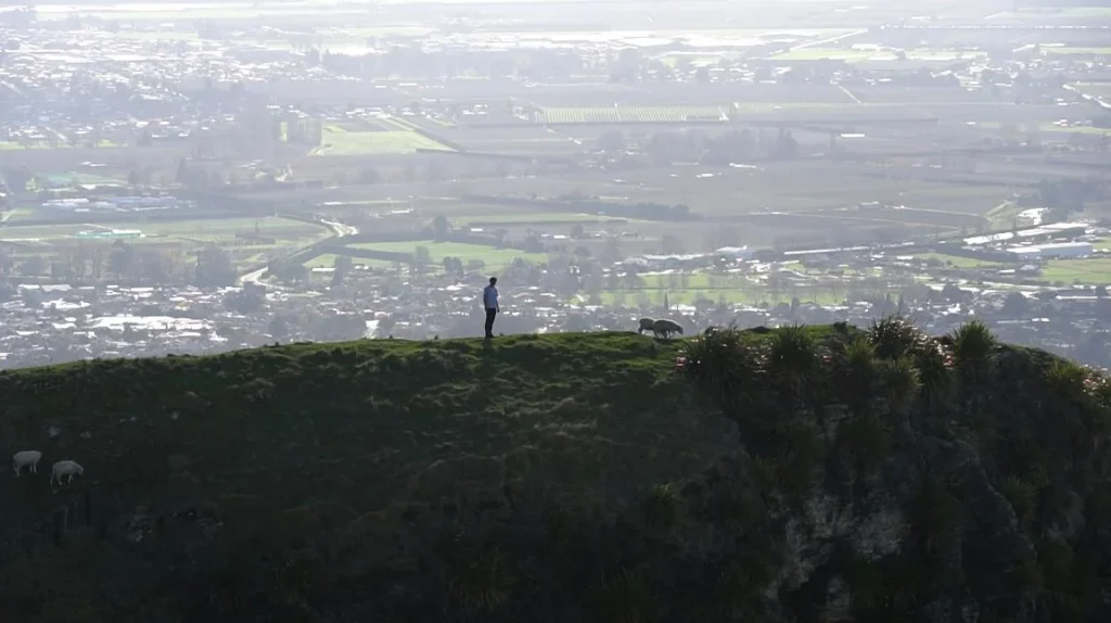
I started out of Rotorua and went south toward Taupo. The scenery itself is beautiful, with undulating hills, flocks of sheep everywhere, that endlessly quintessential New Zealand countryside.

Five minutes north of the Taupo town, I parked my car on the side of State Highway 1 to visit the Huka falls. The surprise about Huka Falls that I had was as follows: it is not a very big drop, only 11 metres. That’s nothing, right? I have seen waterfalls a hundred times over.
However, the statistics speak otherwise.
| Huka Falls Quick Facts | |
| Height | 11 metres |
| River width upstream | ~100 metres |
| Gorge width at falls | 15 metres |
| Water volume | Up to 220,000 litres per second |
| Time to fill Olympic pool | 11 seconds |
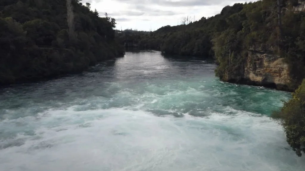
What occurs is that the Waikato River which is usually approximately 100 metres wide is forced through a canyon of a volcanic rock which is only 15 metres wide. That pressure has to be discharged somewhere. The outcome is this bloody, churning spurt of turquoise water which is really difficult to turn away.
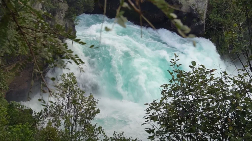
The color is what gets you. That blue-green–blue-green by aeration. The small bubbles of air are whipped into the water as it presses through the small crevices, and they break the light scattering all about giving that particular hue. I was standing on the viewing bridge at least twenty minutes watching. It is hypnotically appealing in some way.
By the way, it is the most popular natural attraction in New Zealand. I can see why.
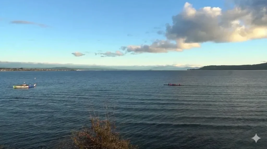
Lake Taupo: Lake Taupo Swimming in a Supervolcano
I was driving into Taupo town after Huka Falls, and I had one place to take a break by the lake. Lake Taupo is huge, 616 square kilometres, about the size of Singapore. It is the largest fresh water lake in Australasia.
However, that is where I began to read more about it, and this is what struck me, you are looking at a supervolcano. The lake occupies a caldera formed by the Oruanui eruption about 25,500 years ago the largest known eruption on Earth in the last 70,000 years. It is 1,170 cubic kilometres of material shot out. As a reference, Mount St. Helens in 1980 generated approximately 1.2 cubic kilometres.
GNS science researches have shown that the lake itself is positioned over a magma reservoir that is estimated to be 250 cubic kilometres of active magma. The volcano has already erupted 29 times since the past 30,000 years. The last large-scale eruption was the Hatepe eruption that occurred around 232 CE -one of the strongest eruptions in the world in the last 5,000 years.
And people water ski here. Fish for trout. Canoe to Māori rock carvings. Something very ridiculous in such juxtaposition.
The lake is named by the Maori, Taupoo-nui-a-Tia or the great cloak of Tia, after the ancestor of a tribe known as Ngati Tuhawaretoa who was the first to discover the lake. The lake bed is owned today by the iwi.
I grabbed a coffee in town and watched kayakers head out across the water. Clear visibility to about 13 metres, apparently. The surface was calm that afternoon, dotted with little balls of pumice floating around—volcanic rock so light it doesn’t sink.
The Road to Napier: Waterfalls You Almost Miss
From Taupo, I took State Highway 5 toward Napier. This stretch—about 140 kilometres—cuts through some genuinely beautiful terrain. Bush-covered hills, farmland, the occasional glimpse of distant ranges.
About 55 kilometres from Taupo, there’s a turnoff that’s easy to miss. Small sign says “Scenic Lookout.” That’s it.
This is Waipunga Falls.
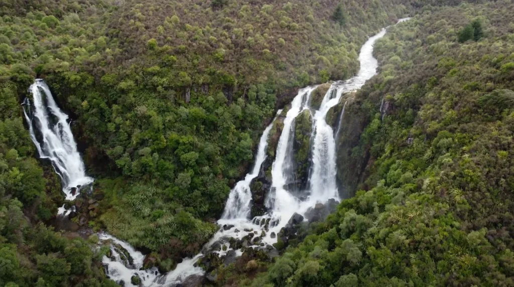
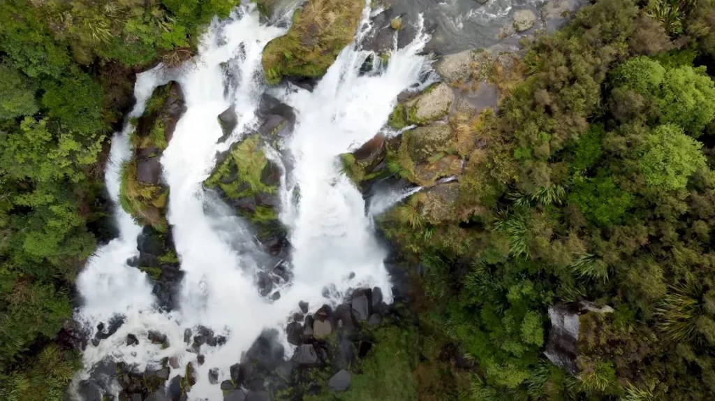
The Waipunga River drops roughly 40 metres here, splitting into three thick columns that plunge through native bush. There’s also a neighboring waterfall—Waiarua Falls—visible if you walk around the viewing spot. No facilities. No gift shop. Just a car park and the falls.
I’d read that the best approach is from the Taupo direction because you can pull off safely to the left. Coming from Napier, you’d be crossing traffic on a fast stretch of highway. Good advice.
What struck me was how loud it was. You hear the roar before you see anything. Then you round the corner and there it is—multiple cascades of white water crashing into the gorge below, surrounded by that dense green bush that New Zealand does so well.
Spent maybe fifteen minutes there. Ate an apple. Took photos. Got back on the road feeling like I’d stumbled onto something most tourists probably drive right past.
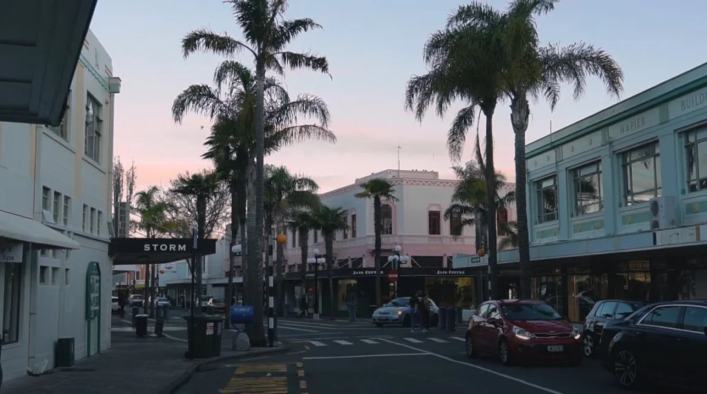
Napier: The City That Rebuilt Itself in Style
Late in the afternoon I drove into Napier. The light was in that golden hour business–soft, warm, and it made everything movie-like. Palm trees lined the streets. I saw art Deco buildings all around.
This is the back story, and it is a nasty one.
The earthquake that occurred on 3 February 1931 at 10:47 am is a magnitude 7.8 quake experienced by the Hawkees bay area. Two and a half minutes the earth shook. Buildings collapsed. Gas mains ruptured. Fires broke out. In the end, 256 individuals had lost their lives and the central business district of Napier was virtually destroyed.
This is what follows, and it is what makes Napier unusual.
The city was forced to start all over again and they did, very quickly, 111 new buildings in downtown between 1931 and 1933, as the Smithsonian indicates. The fashion in the architecture was Art Deco. It was also workable: simple geometrical shapes, concrete construction with reinforcement, not more than two stories high. Earthquake-resistant in nature.
| Napier Earthquake & Rebuild Timeline | |
| Date of earthquake | February 3, 1931 |
| Magnitude | 7.8 |
| Duration | 2.5 minutes |
| Deaths | 256 |
| Buildings rebuilt (1931-1933) | 111 |
| Land raised by earthquake | ~4,000 hectares of seabed |
Source: Napier City Council
The earthquake actually raised about 4,000 hectares of seabed, which the city eventually used for development. Napier literally grew because of the disaster.
The Daily Telegraph Building and Walking the Streets
I parked near Tennyson Street and just walked. That’s the best way to experience Napier’s architecture—on foot, no agenda, looking up.
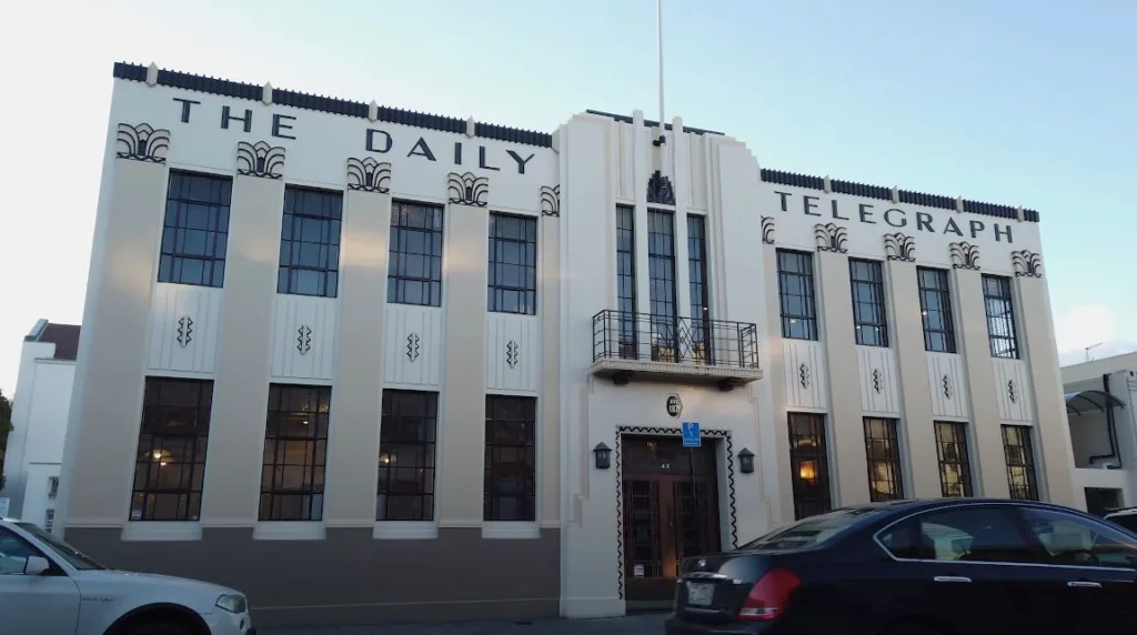
The Daily Telegraph Building stopped me in my tracks. White facade. Bold geometric lettering spelling out “THE DAILY TELEGRAPH” across the top. Those decorative fan motifs—called “sunbursts” in Art Deco terminology—along the roofline. Vertical lines drawing your eye upward. It’s confident architecture. Almost defiant, given what the city had just been through.
The architects of Napier, the four local firms, which united together in the aftermath of the quake in an attempt to share resources, managed to introduce a certain New Zealand flair into their designs (Art Deco Trust). Some of the buildings have Māori decorations. The Prairie Style elements were introduced to the mix by local architect J.A. Louis Hay who was inspired by Frank Lloyd Wright.
The product is Art Deco that no longer resembles Miami or Shanghai or any other place. It’s got its own flavor.
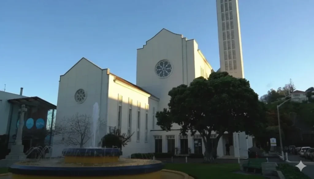
Even the churches received it. I passed one of those with that same opened roof-line, its rose-shaped windows, a high tower–evidently restored after the earthquake, in the same style as all the others. There’s a fountain out front. The entire setting resembled a film set of the 1930s, only that people were living their lives throughout it.
The thing that impressed me as I was walking around was how integrated it becomes. In the majority of cities, one can observe a mixture of all architectural eras: Victorian, brutalist, and glass-and-steel modern. The CBD of Napier is virtually a single time, a single style. The New Zealand Geographic termed it to be in rebuilding as the latest city in the world. The feeling of shared vision can be felt even 90 years later.
Peak House: Lunch With a View
By this point I was hungry. Someone in town had mentioned Peak House, a restaurant up on Bluff Hill with views over the Heretaunga Plains. Figured it was worth the drive.
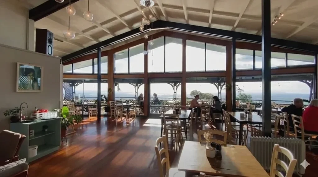
Worth it? Understatement.
The house is literally timber frame and all windows are floor to ceiling. You enter it and, at once, your eyes are on that panorama, farmland all spread underneath, with its patchwork of green and gold, and the hills blurred into haze in the distance. The inside is all relaxed New Zealand hospitality: wooden floors, mismatched chairs, globe pendant lights suspended on their exposed rafters.
I grabbed a table by the window. Ordered something off the lunch menu. Watched a farmer and his dog working sheep on a hillside in the distance.
It gives a certain enjoyment to consume local food and see the land it has been grown on. Hawkes bay is wine country, orchard country, lamb country. That was reflected in the menu: seasonal, regional, unpretentious.
Eating My Way through Hawkes bay
The Hawkees Bay and Napier food scene has a food scene that is well above its weight. Wine, naturally, this is one of the best wine areas in New Zealand, but also restaurants which are doing interesting things with local products.
One night I found myself in a venue that served Asian-fusion small dishes. The type of place having dark light and a menu that is shared.

The first thing that came was a bao bun, freshly steamed bao bun, crispy filling, pickled vegetables, a drizzle of some type of spicy sauce. Simple. Perfectly executed.
Then these fried dumplings with a sweet chili glaze, sesame seeds, fresh herbs. Eaten with chopsticks, washed down with a local wine.

I’ve had fancier meals. There was a something about the combination, good food, a day of driving through beautiful country, that kind of fatigue you develop when you tour an area, that had been memorable.
BurgerFuel: Another Swift Stop on Kiwi Fast Food
Well, to tell the truth, I was eating at BurgerFuel as well. Twice.
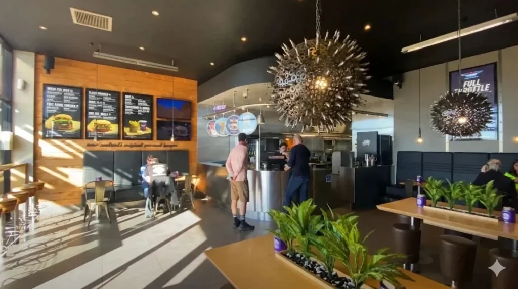
In case you have not heard about BurgerFuel, the company is a chain of fast food restaurants based in Auckland, New Zealand, and originated in 1995. The interiors are… unique. Industrial meets quirky. These enormous spiky metal chandeliers, the urchin of knives and forks, hung suspended in the place where I had halted. Timber paneling. Burger name boards such as Bastard and C.N.J. (Chicken, and then some).
Is it fine dining? No. Does it make it a perfectly good burger following a long drive? Absolutely.
Other times road trips require fast food. I mean I am not going to pretend otherwise.
General Stuff: Strategizing This Trip
To any other person considering making a similar trip, I would recommend the following:
Best Time to Go:
- Warm weather and long days (summer in December- February).
- Autumn (March- May) to beat the crowd and harvest time in wine country.
- Winter also works well – the temperatures in Taupo drop anywhere between -2 to 15 -15 o C, but you will be the only one to attract.
Driving Times (approximate):
| Route | Distance | Time |
| Rotorua to Taupo | 80 km | 1 hour |
| Taupo to Waipunga Falls | 55 km | 45 minutes |
| Waipunga Falls to Napier | 85 km | 1 hour 15 minutes |
| Total | ~220 km | ~3 hours driving |
Don’t Miss:
- Huka Falls (free, 5 mins from Taupo)
- Waipunga Falls lookout (free, easy to miss—watch for “Scenic Lookout” sign)
- Walking Napier’s Art Deco precinct (self-guided or join a tour through the Art Deco Trust)
- The Redwoods Treewalk if starting from Rotorua (~$35 NZD for adults)
Skip If Short on Time:
- Jet boat rides at Huka Falls (touristy, expensive)
- Guided tours when self-guided works fine
Final Thoughts: Why This Drive Stays With You
I’ve been home for weeks now and I still think about that stretch of road. The way the landscape kept surprising me. Turquoise water forcing through black rock. A city that turned tragedy into architectural identity. Waterfalls hidden behind nondescript road signs.
New Zealand’s North Island doesn’t have the dramatic mountain ranges of the South Island. No Milford Sound, no glaciers. What it has instead is this constant, quiet variety. Geothermal weirdness. Volcanic lakes. Rolling green farmland. Art Deco towns. Each thing different from the last, all of it connected by well-maintained roads and that particular Kiwi hospitality.
You could do this drive in a day if you were rushing. I’d recommend three. Stop often. Eat local. Pull over when you see a sign for a lookout.
The best parts of road trips are usually the things you didn’t plan for. A waterfall you almost drove past. A restaurant someone mentioned offhand. A building that makes you stop and look up.
That’s what the North Island gave me. That’s why I’ll go back.