

Guatemala
Tourism & Best Sites to Visit
From towering volcanoes and cloud forests to ancient ruins and highland lakes, Guatemala invites exploration of its natural wonders and archaeological treasures. Each destination unveils centuries of history, vibrant indigenous culture and breathtaking scenery.
-
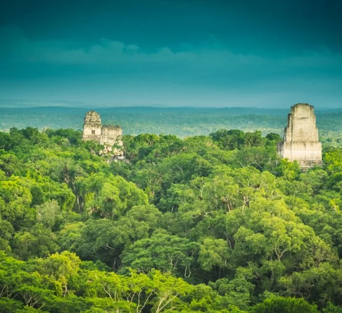
Tikal Deep in the Petén rainforest, Tikal unfolds as one of the greatest Maya cities ever excavated. Towering temples—Temple IV rising over 70 m—peek through the canopy, offering sunrise vistas over the jungle sea. The Great Plaza links the ball court and stelae-lined courtyards, while jaguars and spider monkeys roam the forest floor. Interpretive trails lead to hidden temples and causeways, and night tours illuminate nocturnal wildlife. The on-site museum displays carved lintels, ceramics and jade offerings that reveal Tikal’s role as a major trade and ceremonial center from 300 BC to 900 AD.
-
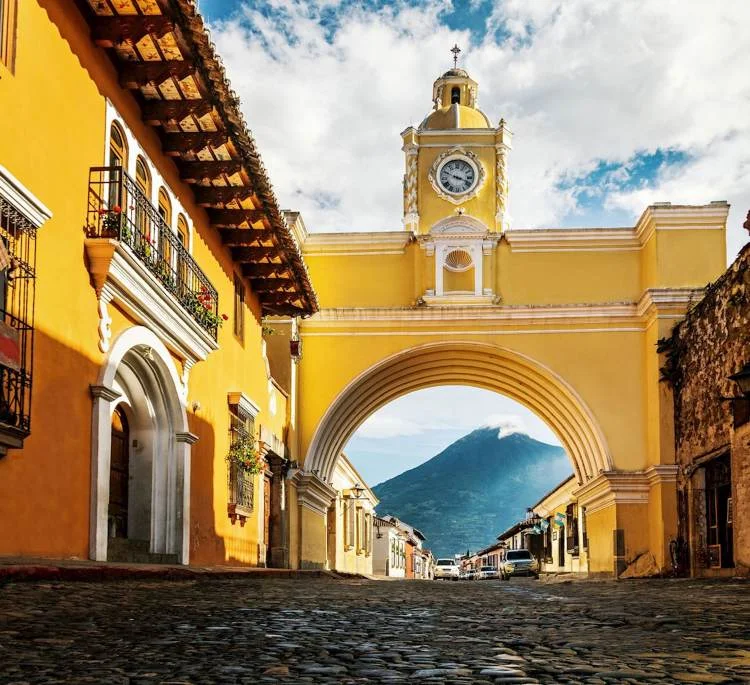
Antigua Guatemala Once the Spanish colonial capital, Antigua enchants with pastel ruins framed by three volcanoes—Agua, Fuego and Acatenango. Cobbled streets lead to the Santa Catalina Arch and the baroque façade of La Merced Church. Each morning, locals lay alfombras—intricate sawdust carpets—for Holy Week processions. Coffee shops occupy restored convents, serving beans grown in nearby highlands. Pottery workshops and textile boutiques line Calle del Arco, while weekend markets offer jade jewelry and handwoven scarves. At dusk, rooftop bars provide panoramic views of volcanic silhouettes against a rosy sky.
-
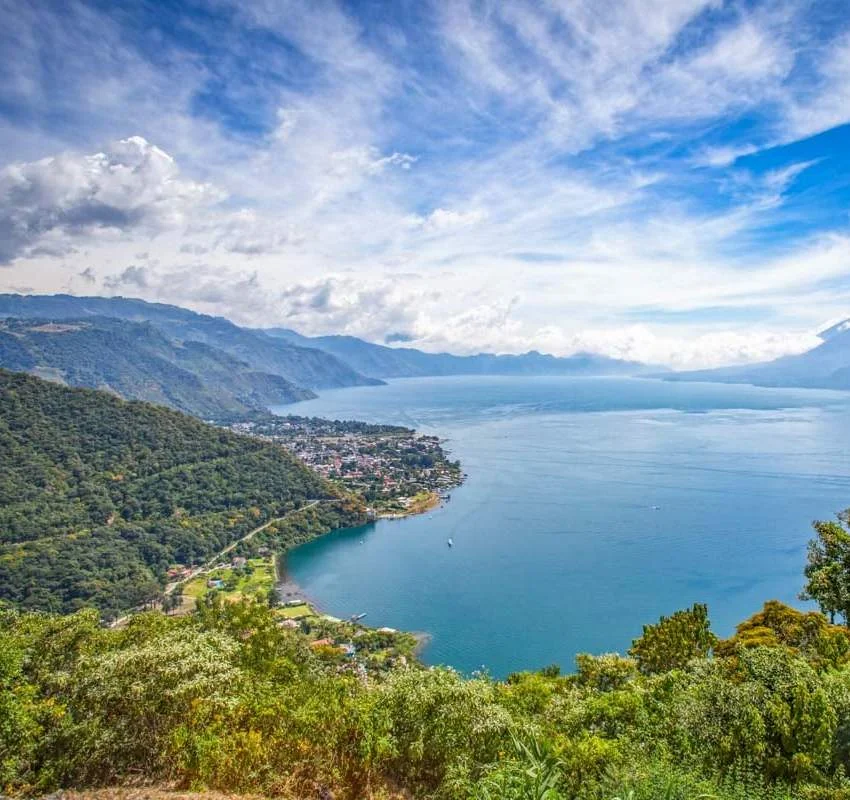
Lake Atitlán Ringed by towering volcanoes—Atitlán, Tolimán and San Pedro—and dotted with Mayan villages, Lake Atitlán’s cobalt waters shimmer beneath sunlit skies. Panajachel’s lakeshore promenade bustles with markets, art galleries and boat taxis to villages like Santiago and San Marcos. Each community preserves distinct textile patterns and religious traditions. Hikes to Indian Nose viewpoint reward early risers with sunrise panoramas, while yoga retreats in Tak’alik Ab’aj offer spiritual renewal. Boat tours reveal cliffs carved by ancient landslides and hidden waterfalls cascading into secluded bays.
-
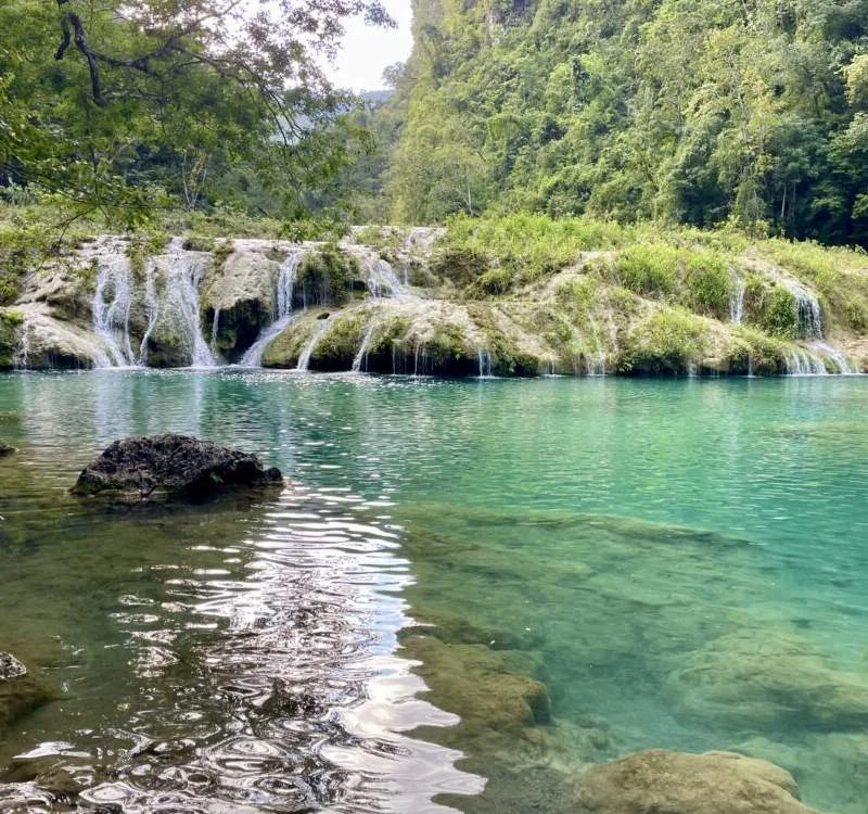
Semuc Champey In the heart of Alta Verapaz, Semuc Champey dazzles with a stepped series of fifteen turquoise pools perched atop a natural limestone bridge. The Cahabón River plunges beneath in a hidden gorge. A steep jungle trail leads to the El Mirador lookout, where the vivid pools glint through emerald foliage. Guided tubing through Karst caves reveals stalactites and Mayan inscriptions. Local guides point out how the water’s mineral content creates the brilliant hues, while explaining Q’eqchi’ Maya legends of water spirits who guard this sacred site.
-
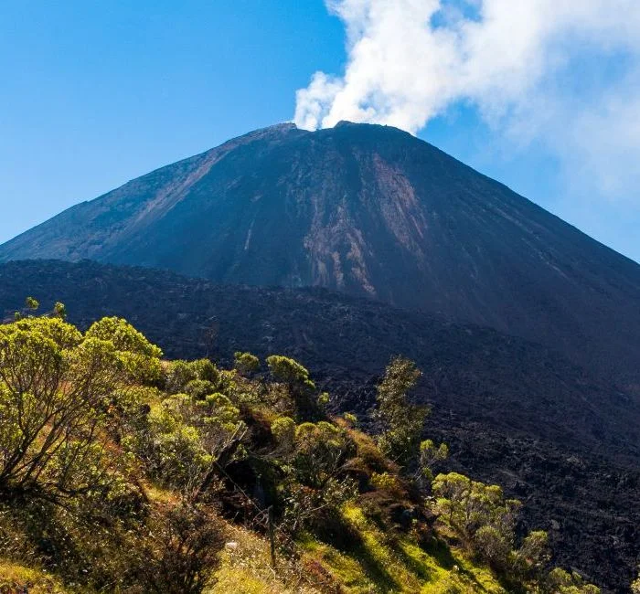
Pacaya Volcano An active volcano east of Antigua, Pacaya offers accessible adventure: a 2-hour hike over hardened lava flows to steaming vents and fissures. Night hikes reveal glowing lava incandescence against the pitch sky. Guides provide walking sticks and highlight volcanic geology—the contrast between basaltic fields and verdant foothills. Roasting marshmallows on hot rocks is a favorite treat. Cooler temperatures at the summit require layers, but panoramic views stretch across the Pacific lowlands and the Sierra Madre Mountains. Park rangers brief visitors on safety and the volcano’s recent eruptions.
-
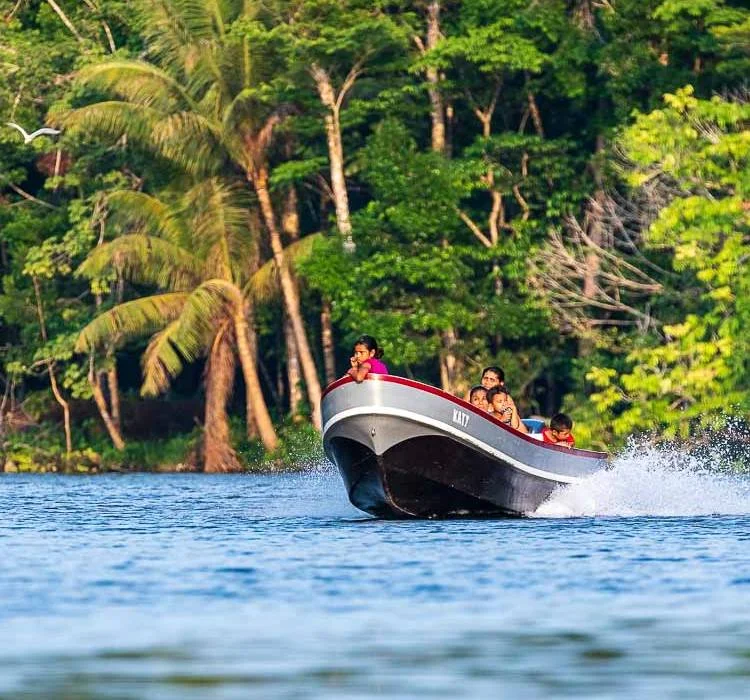
Río Dulce Flowing from Lake Izabal to the Caribbean, Río Dulce carves a verdant canyon flanked by cliffs draped in vines and orchids. Boat tours stop at the 17th-century Castillo de San Felipe, built to fend off pirates, and hot springs where locals soak in thermal pools. At Livingston, the river meets the sea amid Garífuna villages pulsating with drumming and dance. Eco-lodge stays include guided birdwatching—sunset herons and ospreys—and visits to hidden waterfalls accessible only by narrow skiff through mangrove channels.
-
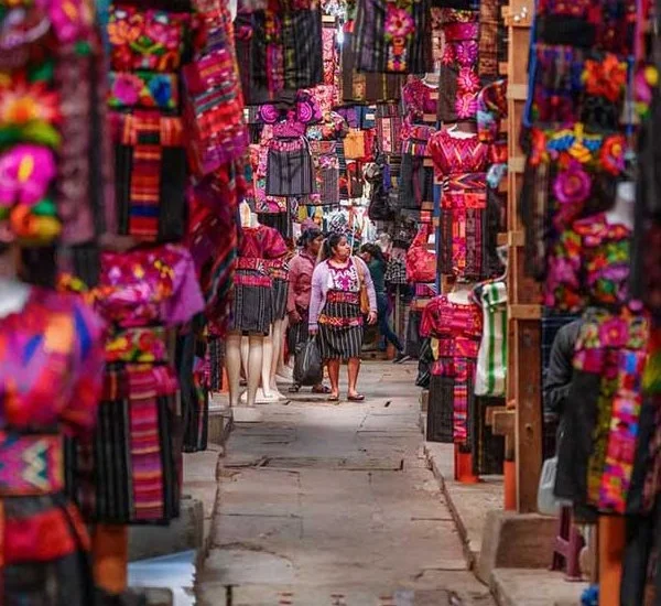
Chichicastenango Market High in the western highlands, Chichicastenango hosts one of Latin America’s liveliest indigenous markets on Thursdays and Sundays. Bright stalls overflow with handwoven textiles, wood-carved masks and pottery. The Santo Tomás Church plaza hosts Mayan rituals—candles, incense and offerings—beside Catholic masses. The nearby Pascual Abaj shrine features carved stones where Q’eqchi’ priests conduct cleansing ceremonies. Visitors navigate a kaleidoscope of colors and aromas, bargaining for skirts, blankets and fresh flowers while sampling corn tamales and atol de elote.
-
Quetzaltenango (Xela) Guatemala’s second city lies in a highland valley at 2 300 m, offering a cooler climate and strong indigenous presence. Neoclassical buildings flank Parque Centroamérica, where marimba concerts echo on weekend afternoons. Nearby Fuentes Georginas hot springs invite relaxation beside steam-shrouded pine forests. Multi-day treks to Tajumulco—the Central American mainland’s highest peak—begin just outside the city. Language schools draw students from around the world for Spanish immersion among friendly Kʼicheʼ Mayan speakers, and local markets brim with artisan crafts and farm-fresh produce.