
It started with a random Instagram post – some influencer standing on a cliff that looked like it belonged on another planet. Green so intense it hurt your eyes. Cliffs that dropped straight into churning Atlantic waters. I screenshot it, forgot about it, then stumbled across it again while stuck in another London drizzle.
Two weeks later, I was on a plane to São Miguel.
What is so unique about the Azores? It is not only the volcanic topography (which is amazing). It is not merely that you can hike up to a waterfall in the morning and then come down to natural hot springs in the evening. It is this queer sensation of having found out some thing that even most people do not know about.
The numbers tell part of the story:
- It has 9 islands spacing over 600km of Atlantic Ocean.
- Population: Just 250,000 people total.
- Flight time from US East Coast: 4-5 hours.
- Flight time from Europe: 2-4 hours depending on your starting point.
However, this is what the tourism boards will not tell you, it rains. A lot. It is fifteen minutes between weather changes. You will have to cover everything with waterproof and even then will be wet.
Worth every soggy moment.
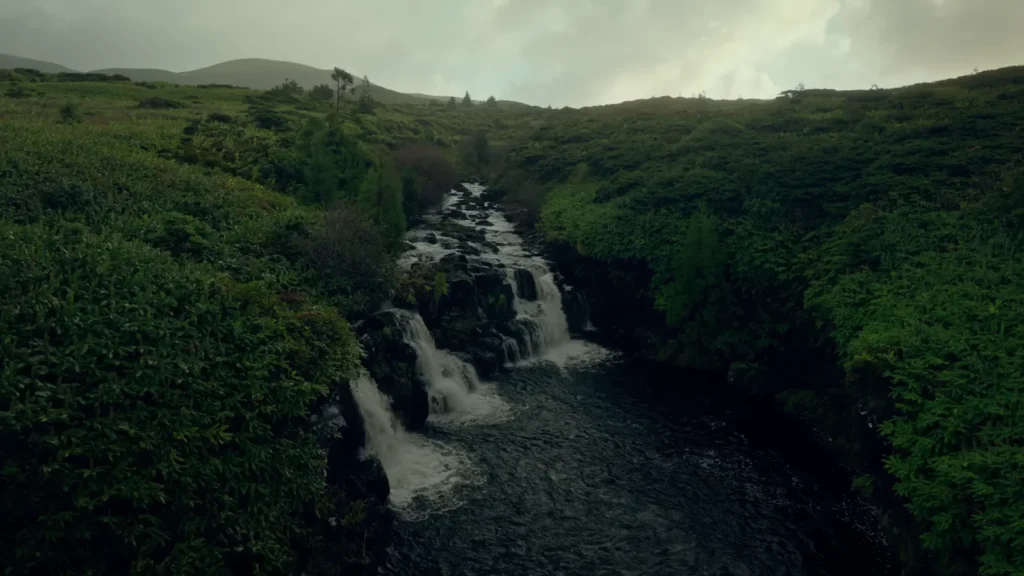
The Waterfall Hunter’s Paradise: Cascata Adventures
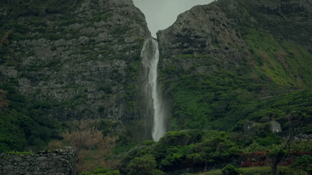
Be very frank with me about chasing water-courses in the Azores. All the blog entries give the impression of a walk through heaven. Wake up call: you will be crawling on slick rocks, searching through narrow paths and wondering how you made such poor decisions at least once during the hiking session.
Cascata do Poço do Bacalhau almost smashed me.
It begins all right at first – there you see what I mean by that fairy-tale entrance to the forest. It is all mossy and fairy-tale and you are walking around in a Lord of the Ring set.
Then it gets real.
The Reality of Azorean Hiking
What You’ll Need:
- Waterproof hiking boots (not sneakers – learned this the hard way).
- Rain jacket that actually works.
- Backup phone battery (for GPS when you inevitably get lost).
- More water than you think.
- Realistic expectations about “easy” trails.
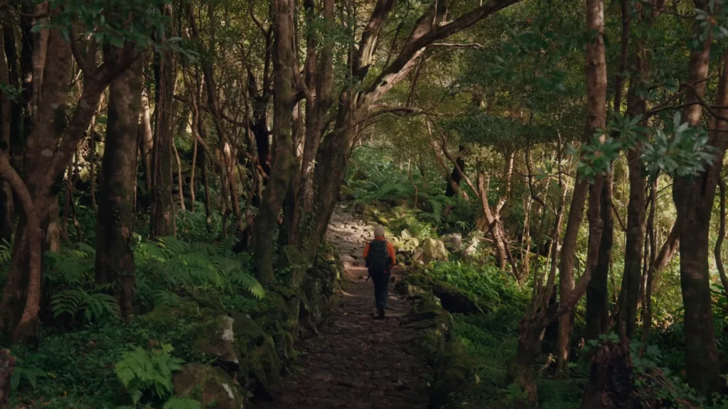
It took me 45 minutes of treading my feet cautiously on the rock to reach Poço do Bacalhau. – here is the prospect, which justifies all that scrambling. This is a perfect natural pool 20 meters down that waterfall, and enclosed by volcanic rock walls, which are bedewed with the greenest moss you have ever known.
But getting back up? That is when I found out I had muscles I was not aware of.
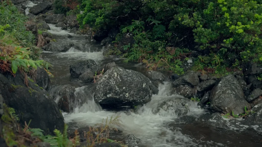
Another Waterfall Worth the Mud: Poço da Ribeira do Ferreiro
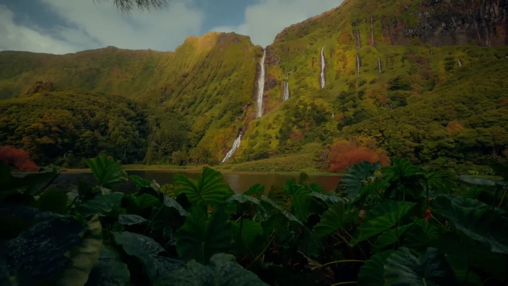
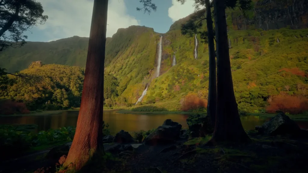
This one’s different. Instead of one dramatic drop, you get this whole cascading system – waterfalls feeding into waterfalls, creating these natural infinity pools. shows how the water catches the light differently at each level.
The hike here is supposedly “moderate.”
Portuguese trail ratings are… optimistic.
I spent two hours picking my way down muddy switchbacks, following paint blazes on trees that sometimes just disappeared. Met exactly three other hikers the entire day. One was a local who gave me directions in rapid Portuguese while gesturing wildly at the forest. Super helpful.
Pro tip: Download the Wikiloc app before you go. It has GPS tracks for most trails, uploaded by people who’ve actually done them. Saved me from getting completely lost at least four times.
Lighthouse Chasing at Golden Hour
Okay, confession time. I went completely overboard with lighthouse photography.
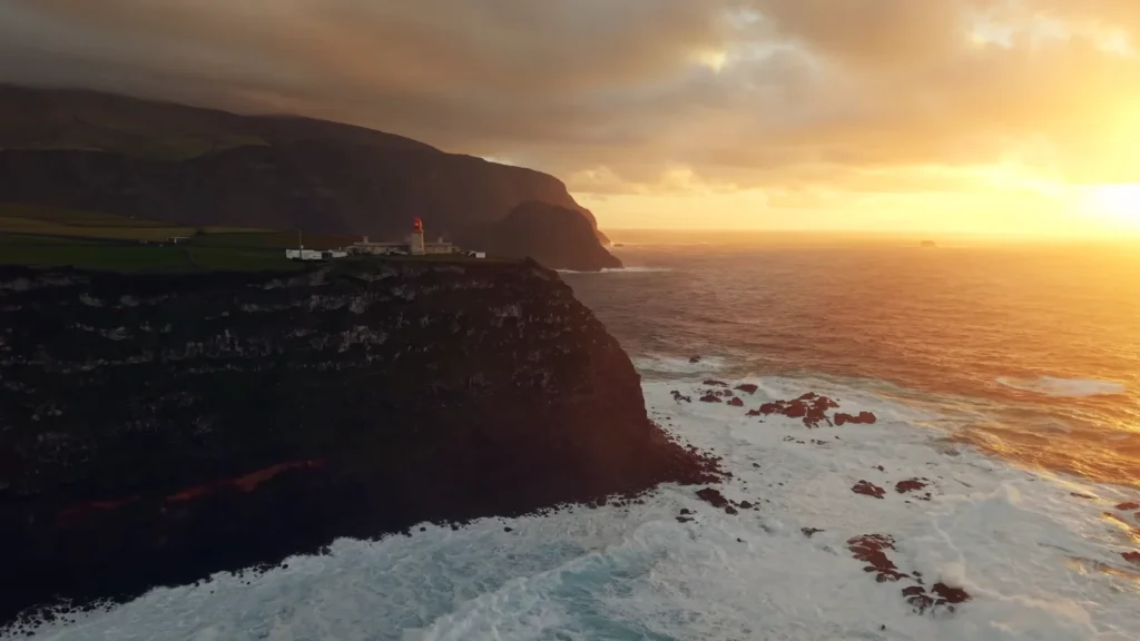
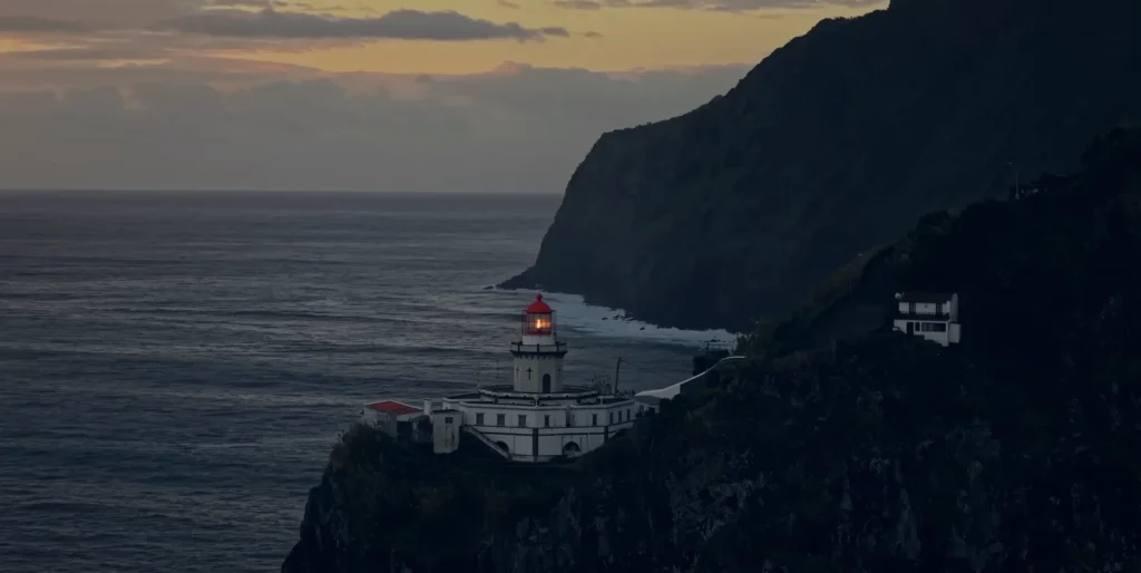
It started with Farol de Albarnaz. I’d driven out there for sunset, not expecting much – just another lighthouse on another cliff, right? Wrong. So wrong.
this is what happens when Atlantic light hits volcanic rock at exactly the right angle. The entire cliff face turns copper and gold, the lighthouse glows like it’s lit from within, and you understand why people move to islands and never leave.
I ended up shooting here three different evenings, chasing different weather conditions.
The Lighthouse Hunter’s Guide
Farol do Arnel
- Best time: Early morning (fewer crowds, softer light).
- Difficulty: Easy walk from parking.
- Special feature: Red and white stripes that photograph beautifully against green hills.
Farol de Albarnaz
- Best time: 45 minutes before sunset.
- Difficulty: Moderate (coastal winds can be intense).
- Special feature: Those golden hour cliff reflections.
The thing about lighthouse photography in the Azores – it’s not just about the lighthouse. It’s about how these human-made structures look so small and stubborn against all that volcanic drama. shows what I mean – that lighthouse is basically thumbing its nose at the Atlantic Ocean.
Weather changes everything here. Same lighthouse, same time of day, completely different mood depending on whether there’s sun breaking through storm clouds or clear skies stretching to the horizon.
Village Life: Finding Flores (and Getting Completely Lost)
GPS said Flores was 20 minutes away. GPS lied.
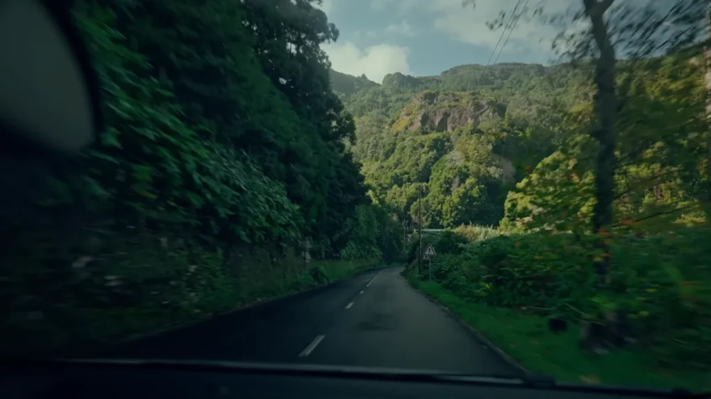
Or maybe Portuguese mountain roads just operate on their own timeline. – this winding road through impossibly green hills should come with a motion sickness warning. And possibly therapy for people who are afraid of narrow roads with no guardrails.
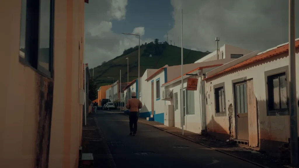
But finding Flores turned into one of those perfect travel accidents.
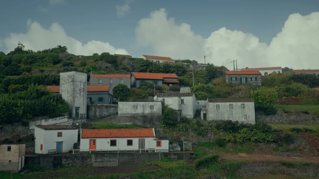
The village itself is small – not more than 200 people, I tell you how small we are talking. White and blue and red tiled roofs, everything in the hillside as though it sprang to being.
I had actually paused to ask directions (I merely speak Portuguese: obrigada and pointing) and was invited to have coffee at the tiny cafe owned by Maria, which is not visible in any map. She also took an hour to show me old photos of the village and how majority of young people migrate to larger islands or mainland Portugal, how tourism is gradually transforming things.
What struck me about Azorean villages:
- Everyone waves at passing cars.
- Most restaurants don’t have websites or phone numbers.
- The best meals happen in people’s kitchens.
- Time moves differently.
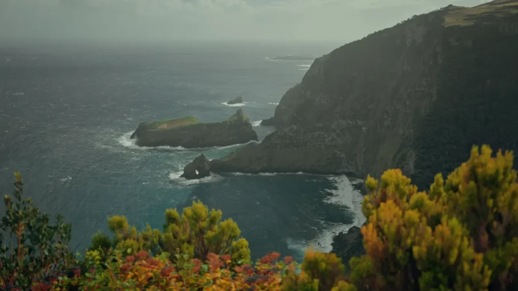
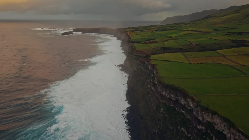
When the Atlantic Shows Its Teeth: Coastal Drama
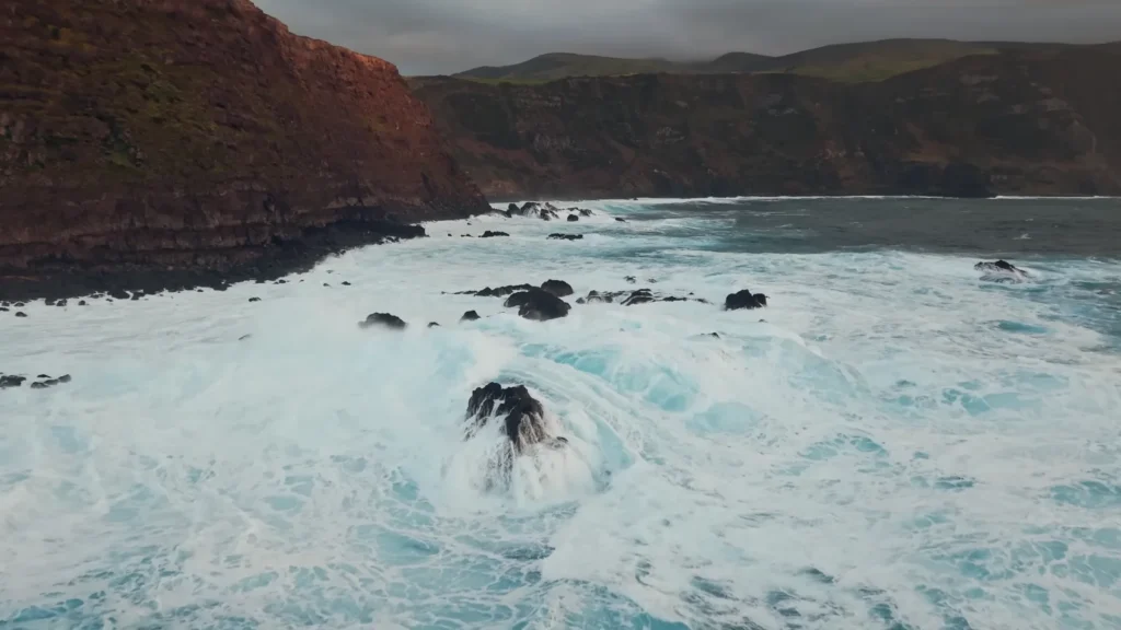
Some coastlines whisper. The Azores scream.
I learned this at Praia dos Mosteiros during what locals casually called “a bit of weather.” The forecast had said “partly cloudy with light winds.” Portuguese weather forecasts, I discovered, are written by optimists.
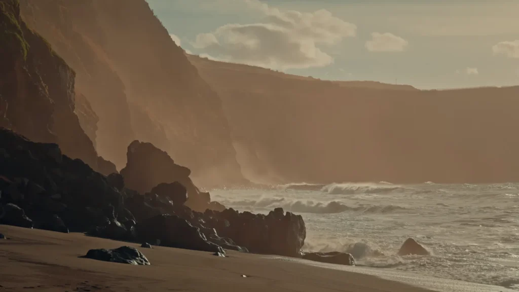
Even the beach itself was something I had never seen. Black volcanic sand burning your feet and peppered with these huge rock formations that resemble ancient giants that have been turned to rock. The local people refer to them as mosteiros (monasteries) since they apparently appear as hooded monks praying in the waves.
I can see it. Especially when storm clouds roll in and the whole scene turns gothic.
What makes Azorean beaches different:
| Traditional Beach | Azores Beach |
| Gentle waves | Waves that could relocate small cars |
| Golden sand | Black volcanic sand (bring flip-flops) |
| Beach bars | Maybe one cafe that closes at random times |
| Crowded | You might see 5 other people |
| Predictable weather | Weather changes every 10 minutes |
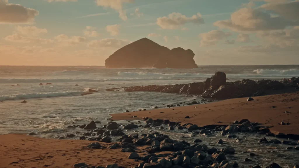
The surf here is serious business. I watched waves crash over rocks that had to be 15 feet high, sending spray another 20 feet into the air. Swimming? Not unless you’re part seal. Even experienced locals stick to the natural pools formed by the rock formations during calmer weather.
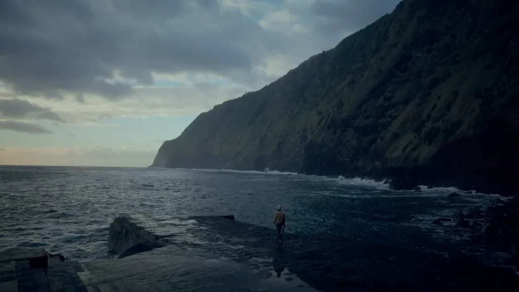
But here’s the thing about these violent, dramatic coastlines – they’re addictive. I found myself driving back to different cliff viewpoints every evening, chasing that perfect moment when storm light breaks through clouds and turns everything silver and gold.
Cliff Walking: A Love Letter to Portuguese Engineering
The coastal walking paths deserve their own section. Portugal has built these incredible trail systems that somehow hug cliffs without falling into the ocean. Most of them.
Safety reality check:
- Winds can literally knock you over (learned this at 6 AM at Ponta da Ferraria)
- Railings exist… sometimes
- Trail conditions change after every storm
- Weather apps lie consistently
- Always tell someone where you’re going
The Azores government trail website has official maps and conditions, but half the trails I hiked weren’t listed there. Locals know secret paths that wind through areas tourists never see.
Tea, Views, and Getting Lost in Green Geometric Paradise
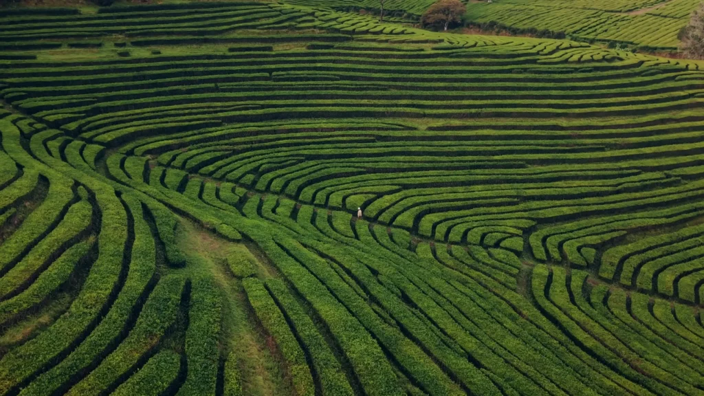
Europe’s only tea plantation sits on the slopes of São Miguel like someone drew it with a giant compass.
I’d driven up to Plantações de Chá Gorreana expecting a quick photo stop. Maybe a cup of tea. What I found was this entire geometric landscape that made my photographer brain completely lose it.
The tea bushes are planted in these perfectly curved rows that follow the natural contours of the hills. From above, it looks like nature and agriculture had a design meeting and decided to show off.
Here’s what nobody tells you about visiting Gorreana:
- Free tea tasting (as much as you want)
- Free factory tours (they actually make tea here, not just for show)
- The gift shop prices are lower than anywhere else on the island
- The best photo spots are behind the main building
- They close at 5 PM sharp (learned this the hard way)
The tea itself? Surprisingly good. They have been cultivated here since 1883 and the volcanic soil seems to have a peculiar mineral flavor which is only found here. I am not a tea drinker, and I even purchased six boxes to be taken home.
It was this incredible combination of ancient culture and the new world with its efficiency that the factory tour became. People sort leaves manually as their grandparents used to do and machines that were manufactured in the 1970s handle the heavy work. The entire area is impregnated with green grass and history.
However, the magic of the situation is even greater when you hike the hill behind the plantation and observe the entire geometry pattern under your feet. It is aerial art, only that it has been made using thousands of tea bushes that the person has been meticulously shaping during the last 140 years.
Crater Lakes That Break Your Brain
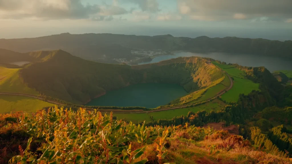
Standing at the Sete Cidades viewpoint feels like discovering someone’s secret.
Two lakes. Same crater. Different colors.
Situated on the same side of this huge volcanic caldera, 12 kilometers square, are blue and green. It is only by this body of water that the blue one (Lagoa Azul) and the green one (Lagoa Verde) are technically two different entities. They are entirely different colours, however.
Nobody really knows why.
The science bit:
- Different depths reflect light differently
- Different algae content affects color
- Different mineral compositions from surrounding rocks
- Weather conditions change how they look
- Or maybe it’s just volcanic magic
To reach the most excellent possible viewing point, it is necessary to have a road which adds 500 meters of elevation in a distance of about 3 kilometers. The rental car (a small Opel that strangled on anything that looked like a hill) sounded in a manner I had been unaware cars can do.
The standard shot that every one takes is the Vista do Rei. However, this is what I learned after a half-day of sightseeing about it – there are at least half a dozen different points of view around the crater rim, and they all present totally different points of view.
My viewpoint ranking:
- Vista do Rei – Classic shot, decent parking, gets crowded
- Miradouro da Boca do Inferno – Fewer people, better light in afternoon
- Secret spot behind the abandoned hotel – Best colors, sketchy access
- Walking trail along the rim – Multiple angles, exercise required
The walking trail around the crater rim is officially 12 kilometers. It felt like 20. The weather changes constantly up there – I started in sunshine, hiked through fog so thick I couldn’t see 10 feet, then ended in light rain that somehow made everything more beautiful.
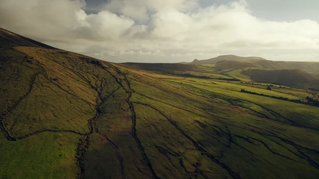
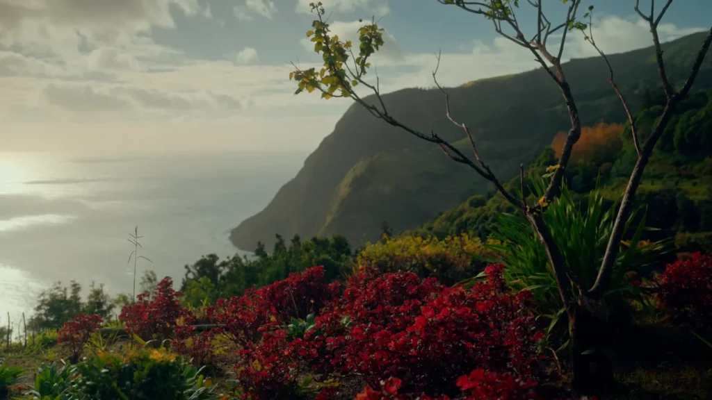
The Green That Doesn’t Exist Anywhere Else
That last image captures something I struggled to explain to friends back home. The Azores aren’t just green. They’re Green with a capital G. Green that makes Ireland look faded. Green so intense it looks artificial in photos.
Why everything’s so impossibly green:
- Volcanic soil rich in minerals
- Consistent rainfall year-round
- Mild temperatures (never freezes, rarely gets hot)
- Gulf Stream influence
- Perfect humidity levels
- No major pollution sources
There is an impression that driving through the interior of São Miguel is traveling through a living postcard. Grass-grown rolling hills so smooth that they appear to be trimmed, the walls between the fields so old that they are centuries old, the farms here and there with red-roof houses that an artistic director would have placed there.
The agricultural landscape tells this incredible story of human adaptation to volcanic terrain. Farmers have been working with (and around) volcanic activity for 600 years. Stone walls aren’t just decorative – they protect crops from volcanic ash and salt spray from the ocean. Field patterns follow lava flow lines from eruptions centuries ago.
Planning Your Own Azores Obsession: The Real Talk
Best time to visit: May through October, but…
- June-September: Warmest, most crowded, highest prices
- April-May: Flowers everywhere, fewer people, unpredictable weather
- October-November: Still warm, amazing light, some restaurants close
How long you need:
- 4-5 days minimum for São Miguel highlights
- 7-10 days to really explore without rushing
- 2 weeks if you want to visit multiple islands
Budget reality check:
- Accommodation: €40-150/night depending on location and season
- Car rental: €25-40/day (essential – public transport is limited)
- Food: €15-30/meal at restaurants, €5-10 for simple local places
- Fuel: Expensive (around €1.60/liter)
- Activities: Many hikes and viewpoints are free
What to pack that actually matters:
- Waterproof everything (jacket, pants, backpack cover)
- Layers for temperature changes
- Good hiking boots with grip
- Portable phone charger
- Cash (many small places don’t take cards)
Getting around: Rent a car. Don’t debate this. The island is small enough that you can drive anywhere in under an hour, but buses are infrequent and don’t reach the best spots. I used Rentalcars.com and had no problems.
Where to stay:
- Ponta Delgada: Best restaurants, nightlife, central location
- Furnas: Near hot springs and volcano activities
- Ribeira Grande: Quieter, good for surfers
- Small villages: Authentic but limited dining options
The Azores changed something in me. Maybe it’s the way the light hits those volcanic cliffs at sunset. Maybe it’s how you can hike through fairy-tale forests to waterfalls that feel like secret worlds. Or maybe it’s just the realization that places this beautiful still exist, waiting for you to discover them.
Three months later, I’m still dreaming about those impossibly green hills.